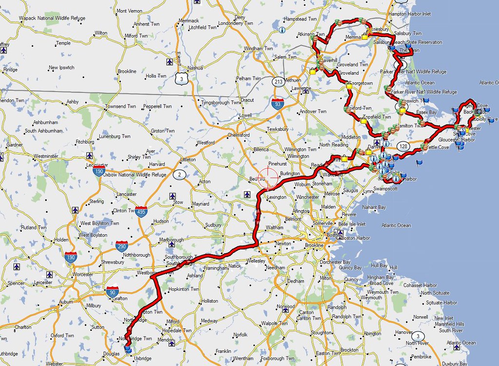
With that said as background on Wednesday August 15th I headed to the north shore of Massachusetts, also known as Cape Ann which includes places like Salem, Gloucester, Rockport, Essex, Ipswich and even crossed the border briefly into New Hampshire. Headed up RT 128 (aka I-95) to Salem for my first stop and grabbed the First Methodist Church

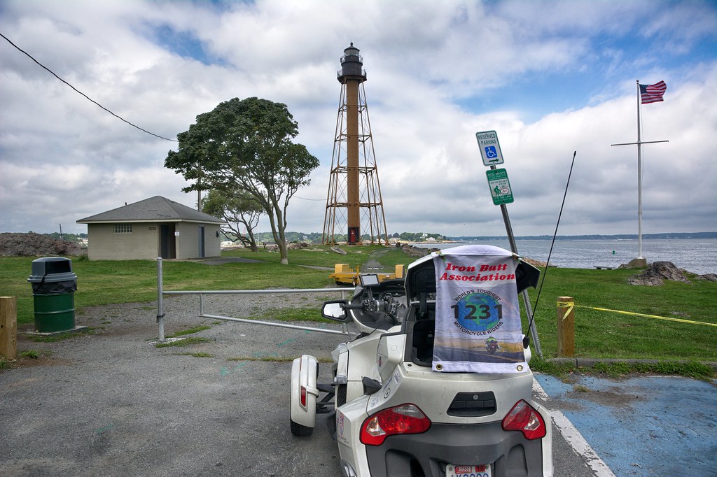
Grabbed a couple of other non interesting spots and headed to Marblehead for my first lighthouse. Not a particularly good looking lighthouse, but it counts for the IBA. The current tower is a skeletal structure that replaced the original 1835 brick and wood tower in 1895. It is the only tower of its type in New England, the next similar tower is to be found at Coney Island, New York. (Source Wikipedia)
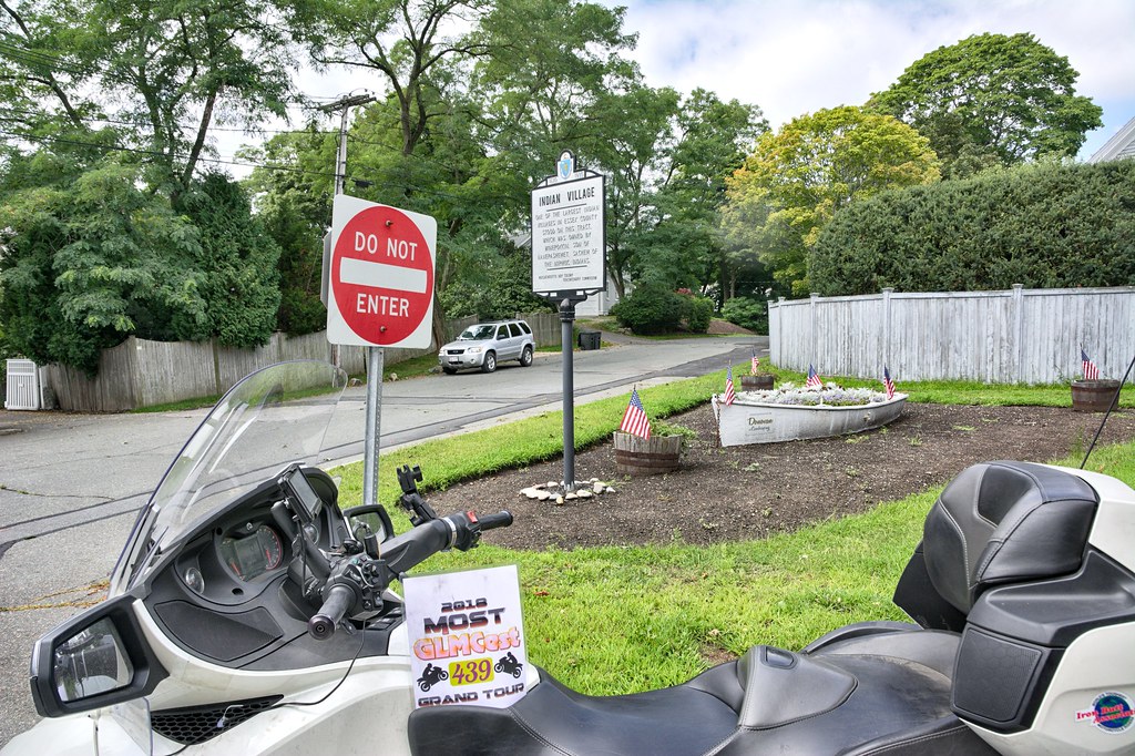
Coming off the peninsula was a Mass Bay historical marker. I have been casually collecting these over the last 10 years and this did have a ST word in it. These were put up in 1930 all around Massachusetts.
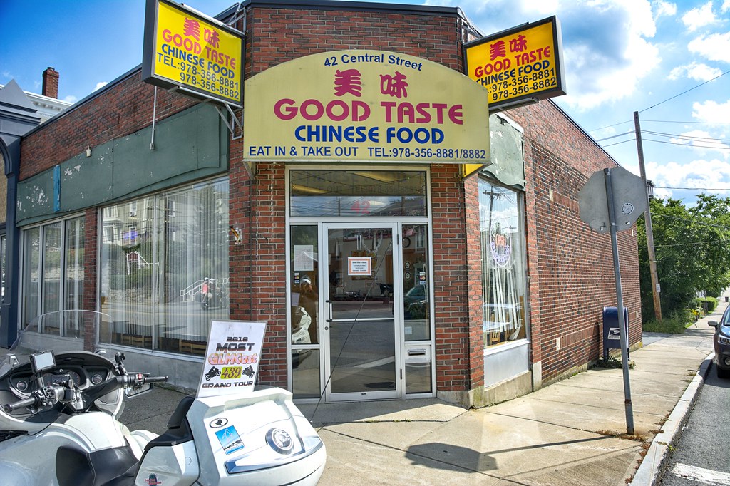
Headed into Marblehead proper for some more churches starting with FIRST and then back into Salem. This place has been around for more that 40 years under various owners. No clue if the food is any good but the sign is big and cool.

I enjoy riding around cities, especially if they are historic or have neat little shops with people wandering all around. Salem is just that kind of town. These guys claim to be the Oldest Candy Company, as ST capture.

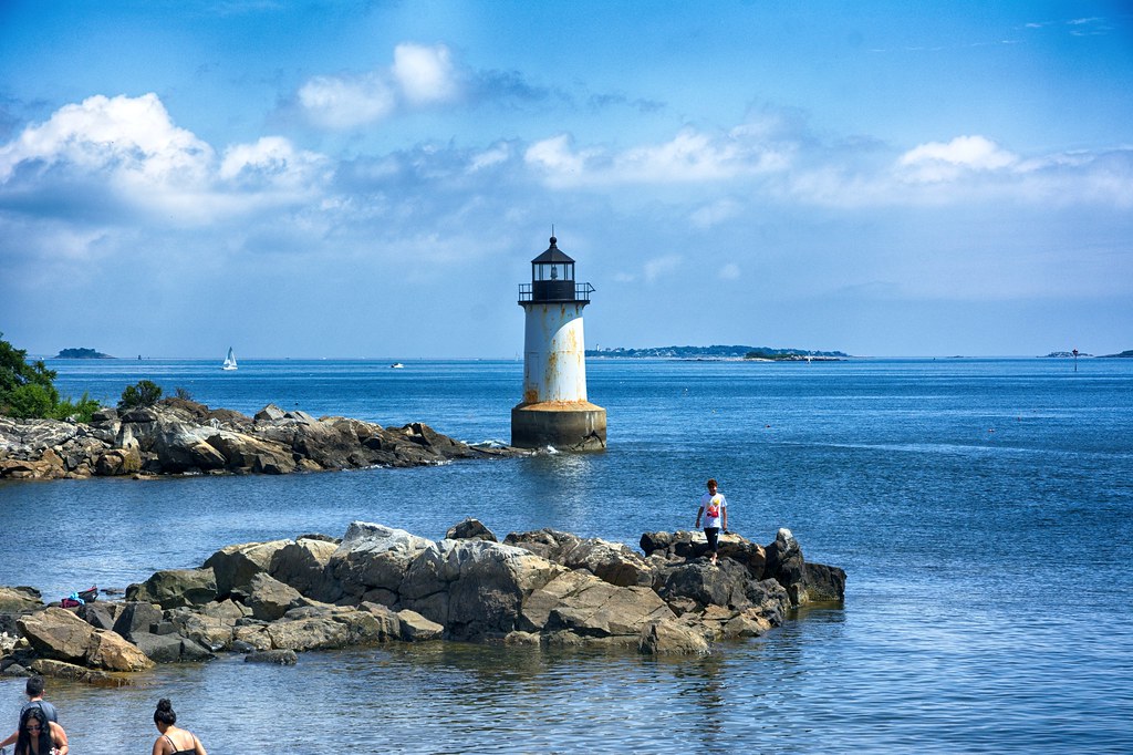
On Winter Island (no longer an island) is this very picturesque lighthouse. Fort Pickering Light, also known as Winter Island Light, is a lighthouse built in 1871 and discontinued by the Coast Guard in 1969.

A snapshot sans flag
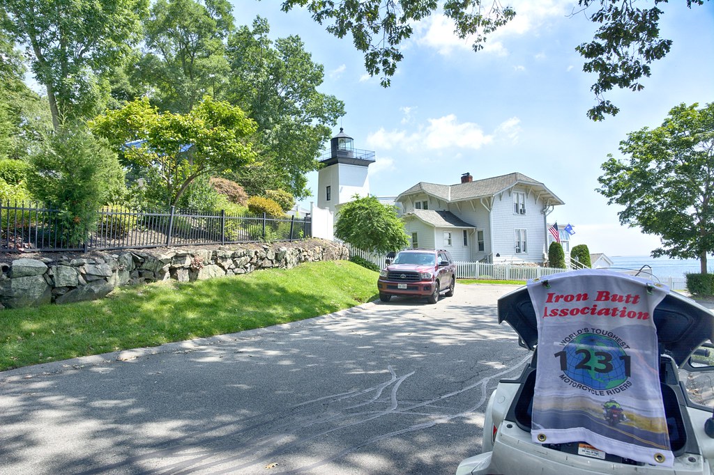
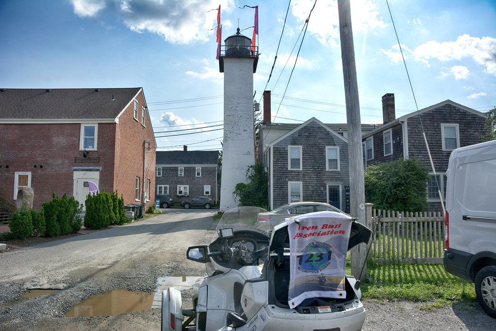
Over the Danvers River into Beverly this spot served 2 purposes. One it is the The First Baptist Church and is also the Hospital Point Rear Range Light. On May 1, 1927, Hospital Point Light was officially renamed Hospital Point Range Front Light, as a beacon was cobbled together, using equipment from a lightship, and placed in the steeple of Beverly’s First Baptist Church to serve as a rear range light for entering Salem and Beverly Harbors. Source: lighthousefriends.com. Tough shot to capture. It really doesn't bend.

The Hospital Point Front Range was built in 1871. Hospital Point Light is owned and operated as a navigation aid by the United States Coast Guard. The light is paired with a second light installed in the steeple of Beverly's First Baptist Church in 1927. Vessels are able to use the two lights to align themselves with the middle of the channel, avoiding the rocky shores. Source: WWikipedia
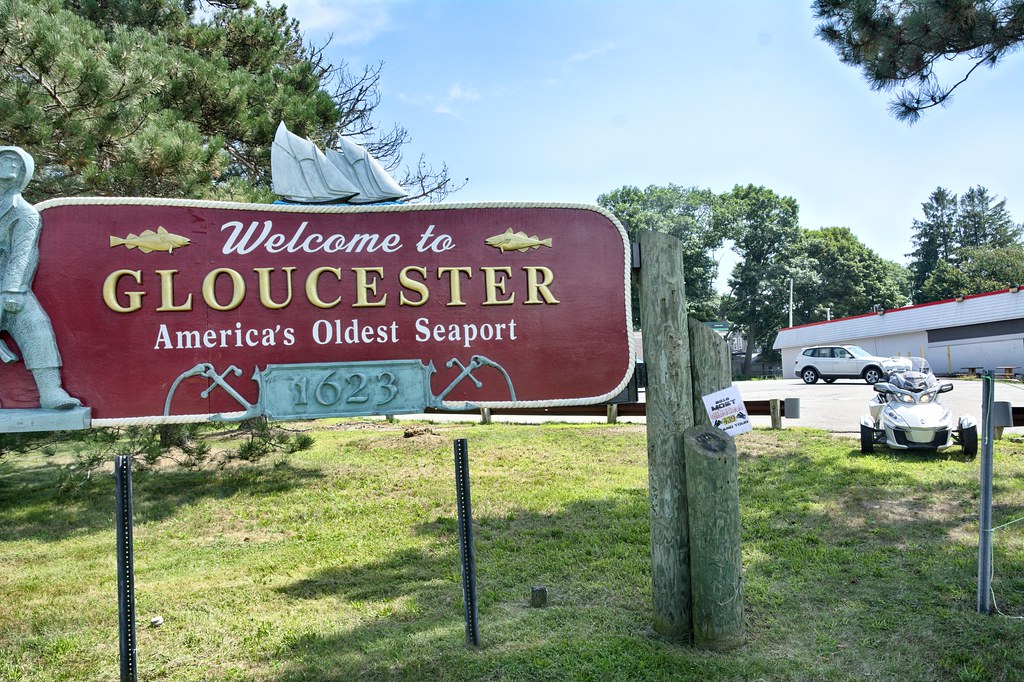
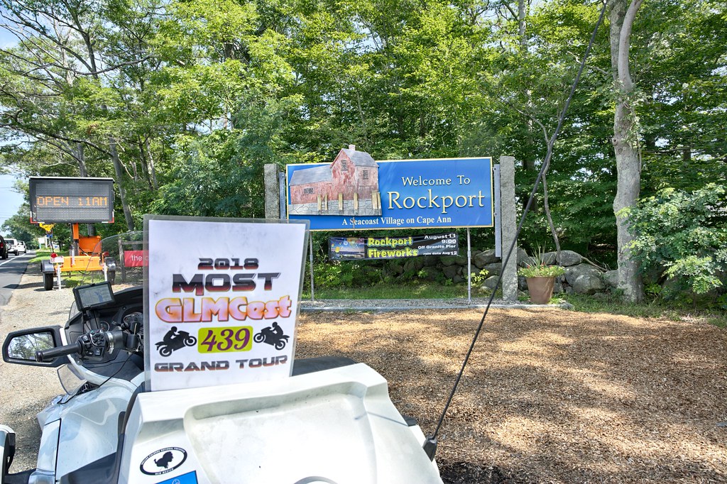
Headed north to Gloucester and Rockport. Grabbed this for the ST tour and I thought the name was pretty creative.

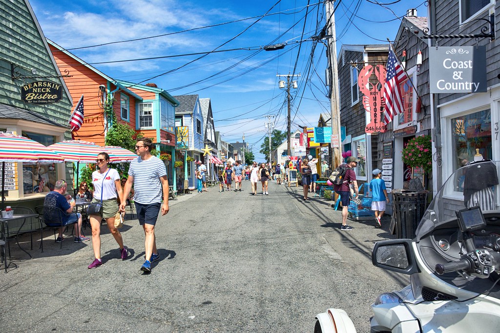
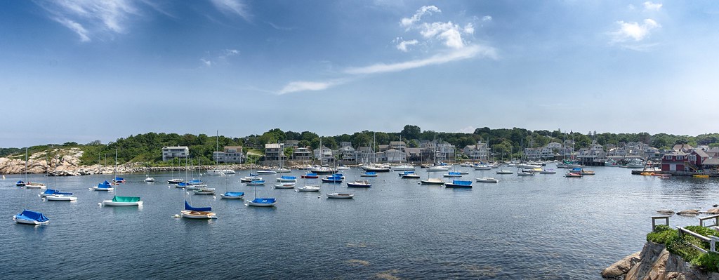
In Rockport I headed down Bearskin Rd which is full of people walking in the middle of the road, darting in and out of the little shops, not a great place for 2 wheel motorcycle like my FJR. On the Spyder is was as if I was walking right along the rest of the folks. Got to the end of the road for the lighthouse a screwed up the picture (noticed this when I got home) but did get a pretty could snap of the harbor itself.
Headed for the Annisquam Harbor light knowing full well I would not be able to get a picture. As I turned onto the street I noted (ignored) the PRIVATE DRIVE sign. Also saw many sign saying there was no visible spot for pictures of the light house. Maneuvered the Spyder up and over the speed bumps. At one Y there was a traffic cone in the middle of the left branch so I went right. No lighthouse view from this one. As I headed back there was no traffic cone in the road, so I simply kept going straight reading all the signs "No Picture of the Lighthouse". Came across some folks coming up from the beach and figured I was going to get chewed out about being on a private road. Slowed and then stopped to take my tongue lashing, however to my surprise one woman was asking me all sorts of questions about the Spyder and the gentleman commented how quiet it was. Guess what, got to the end the signs were right, couldn't get a picture of the lighthouse, bike and flag in it. I could have walked onto the beach and got one, so maybe this fall I will head back up here with Crystal for another try.
Next up is Ipswich. When I first moved to Massachusetts I used to go to Cranes Beach with my friend Rick. What I remember about the beach were the "green heads", a particularly nasty fly with big green eyes (like Vincent Price has in the movie the Fly, even thou it was in black and white) that draws blood upon landing on you. Here's an interesting article on them in Yankee Magazine. CLICK HERE to READ
https://newengland.com/yankee-magazine/living/pests/greenheads/
So I digressed to another point in my life. I downtown Ipswich I was headed Zeno's Roast Beef and Seafood, but saw this place. What a great ST place. Hung a U-Turn in the middle Central Avenue, pulled up right next to the spot, parking illegally, jumped off the bike, grabbed the shot all to realize that TASTE has an E on the end of it and won't work for a ST spot. So I refocused and grabbed Zeno's
Off to Newburyport for 2 lighthouses. One on Plum Island and the other in downtown Newburyport.

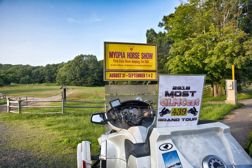
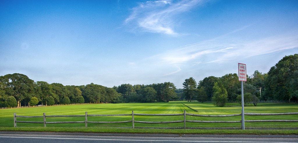
In Hamilton saw the Myopia Horse Show sign with is also where they play Polo. First picture for the ST, right across the street is where they play Polo. I wonder how much their lawn care people charge.
From here I meandered up into New Hampshire back down thru Haverhill, Georgetown back into Beverly for my last stop in Peabody. Jumped on Route 128 and headed home.

This journey started 9:30AM and ended 278 miles later some 12 hours later. All in all it was a successful point capturing day and a great visual day.
2 comments:
wow you did some miles! nice write up.
Good read, makes me want some roaST beaST.
Post a Comment