The American Guide Series was a group of books and pamphlets published in 1937–41 under the auspices of the Federal Writers' Project (FWP), a Depression-era works program in the United States. Source: wikipedia
Within these books are various tours one could go on telling the reader if the road is paved, kind of road and interesting points along these routes. The AGS calls these tour, and this writing is from Rhode Island, A Guide to the Smallest State, and specifically about Tour 4B. Tour 4B starts in Woonsocket, follows RI104, with some side loops and ends at the intersection of US44 and RI104.
This writing is almost purely historical and follows the AGS route.
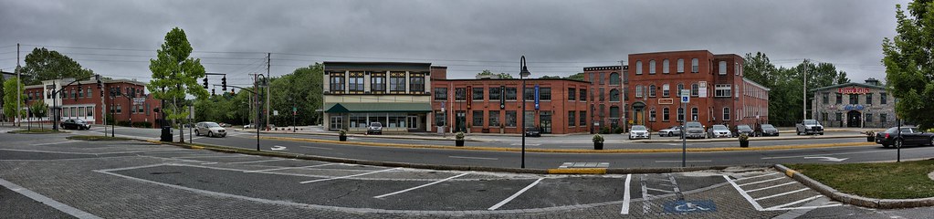
First stop on the tour is Market Square in Woonsocket.
From the AGS
Market Square, 0.2 m., is near the oldest section of the city; it was in this neighborhood that the first textile mills were erected about 1810. The buildings still visible, though timeworn, are of the second or third generation of factory development.
Woonsocket Falls Village was founded in the 1820s. Its fortunes expanded as the Industrial Revolution took root in nearby Pawtucket. With the Blackstone River providing ample water power, the region became a prime location for textile mills. Source Wikipedia
Woonsocket population expanded with migration of the French Canadians to this area to work in the textile mills. It was thriving town thru the Great Depression (1930's), collapsed and then revived during World War II, due to the ability to produce large quantities of fabric. It has since suffered another decline beginning in the 1980's
On a personal side the building almost dead center is the Museum of Work and Culture. This was my first INK (National Park Cancellation Stamp) capture which began my first National Park Tour for the Iron Butt Association back in 2008. It was also here I discovered the video each site has that are quite information and well done.
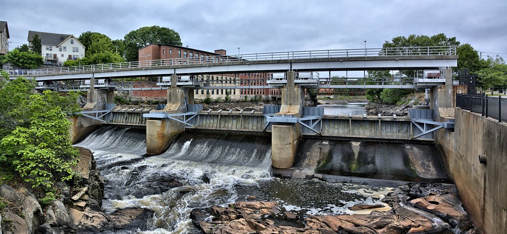
Right across the street is Woonsocket Falls and Dam.
From the AGS
Right of the bridge, 0.3 m., over the Blackstone River is Woonsocket Falls. From this point South Main St. bears uphill through what is known as the Globe section of the city, passing (L) the Woonsocket State Armory and the Globe Congregational Church.
The Woonsocket Falls Dam on the Blackstone River was completed in 1960 for flood control, drinking water and electrical power generator. The dam is 268 feet in length.
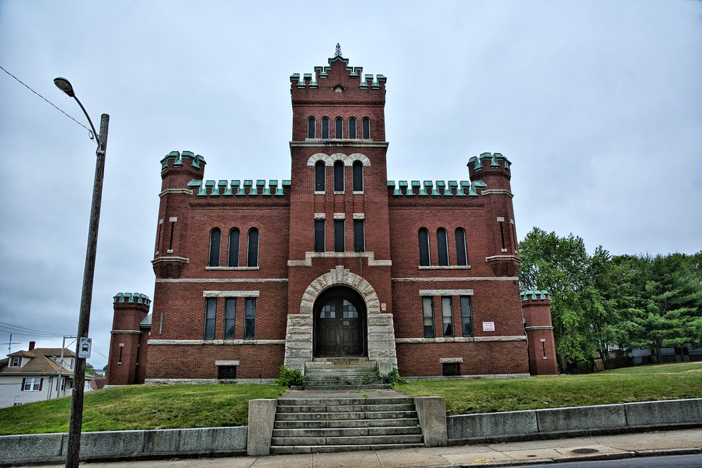
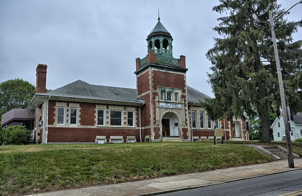
Next 2 stops are right next to each other, Woonsocket State Armory and the Globe Congregational Church. There were 18 state armories built in Rhode Island. The Globe Congregational Church is not your typical Congregational Church, which would be a wood structure, with steeple and a double set of doors, off center. My stereotypical description of the church did exist, directly across the street and was destroyed by fire in 1904. The congregation moved into the this church, now the St James Baptist Church.
From the AGS
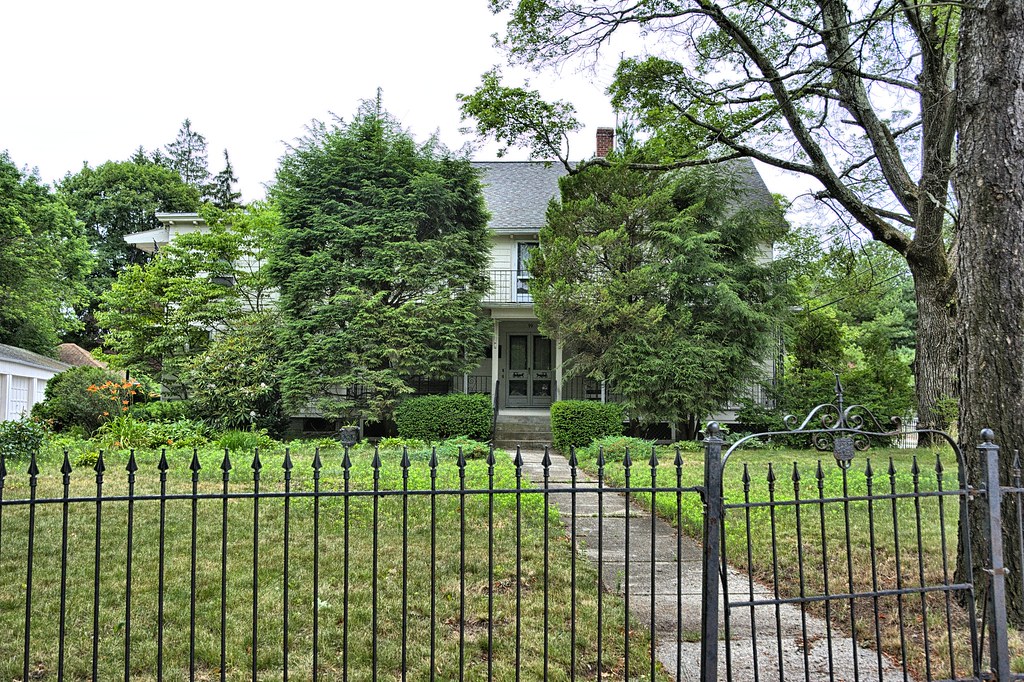
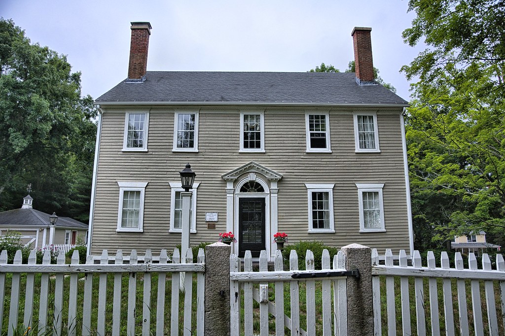
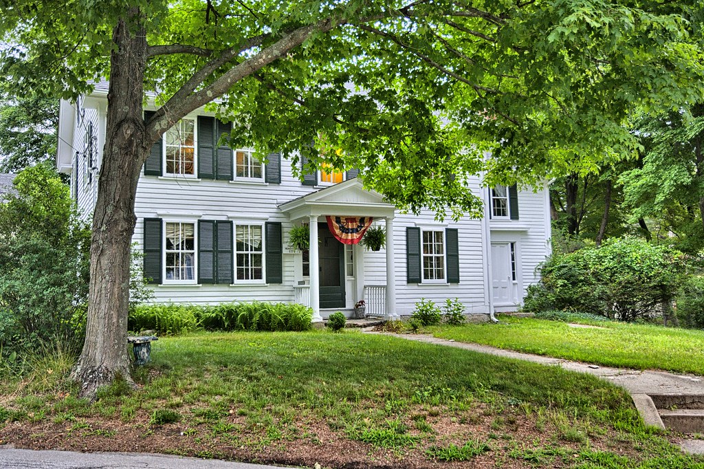
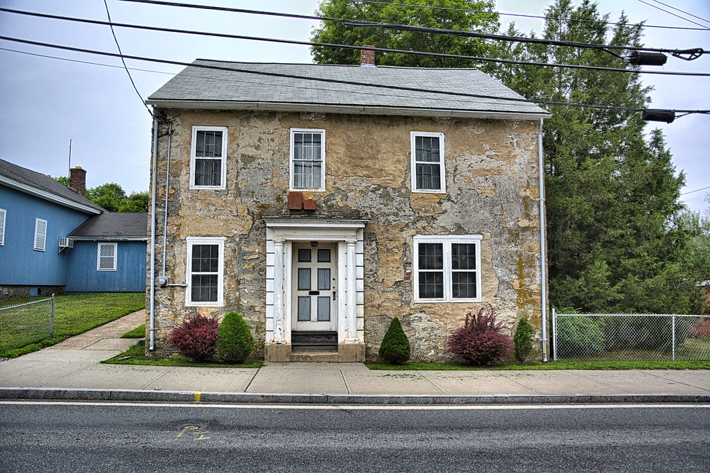
The John Arnold House, 0.7 m. (R), built in 1712', has been so remodeled that it does not appear to be a Colonial structure; the Willing Vose House (see WOONSOCKET), 0.8 m. (L), is not as old as the Arnold House, but is in a poorer state of repair.
Tough picture of the Arnold house, it is so overgrown. Had to do quite a bit of research to find this place, found a picture relating to its nomination form for the NRHP. Never could figure out which house is the Willing Vose House
The route leaves the urban confines of Woonsocket and heads into the rural roads of Smithfield, home to Bryant University and Tupperware.
From AGS
The Ananias Mowry House (private) (L), 3.2 m., is a plain, well-preserved two-and-one-half-story frame structure with gable roof and central chimney (about 1700). The clapboarded exterior is painted yellow with green trim and there is an old well-sweep in the back yard. The place is occupied by Dr. George R. Smith, a descendant of the original builder. Many Mowrys were among the early settlers of Rhode Island Colony, and the family name is still prominent in the State.
Nothing real special about this place. The Mowry's date back to 1666 and settled in the area right around the time Roger Williams was forced out of Boston. Ananias was born in 1705 and died in 1790.
This stop has nothing to do with American Guide Series, just stopped to take the picture

Up next is the Old Yellow Tavern
From AGS
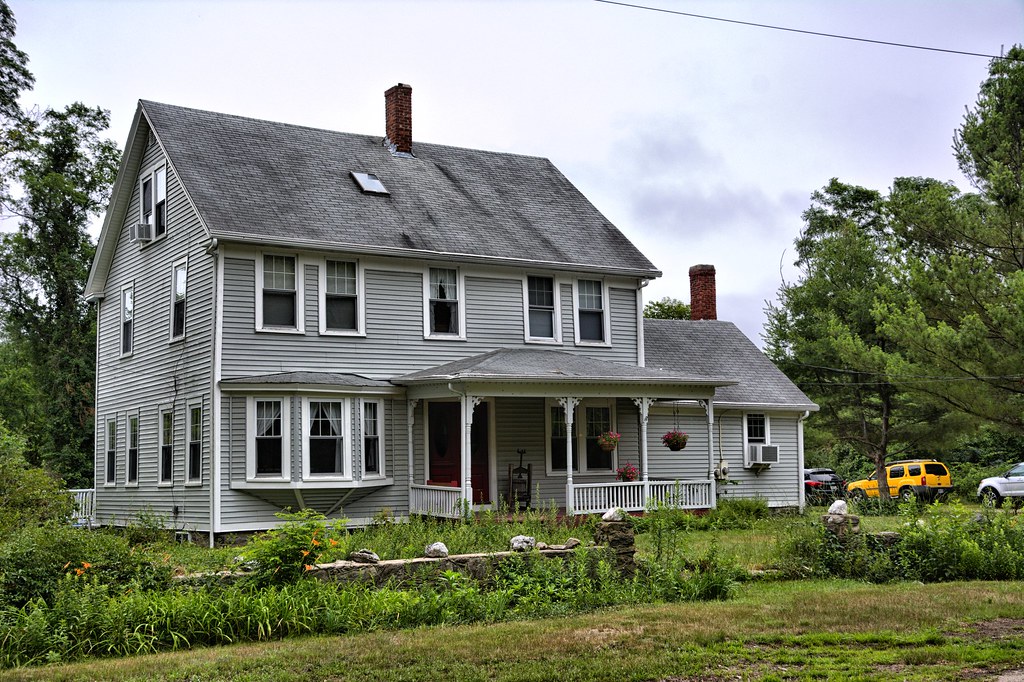
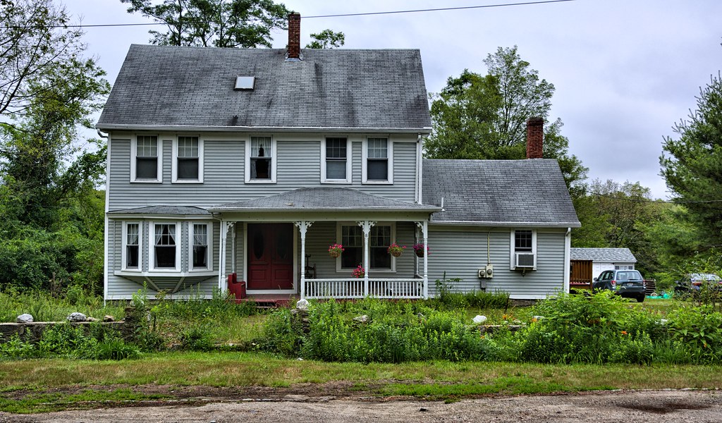
Old Yellow Tavern (private] (R), 7 m., is a severely plain two-and-onehalf-story clapboarded structure with gable roof and central brick chimney. The windows and doors are asymetrically disposed. This old tavern, still yellow in color though weather-beaten, is sometimes called the Halfway House because it is about halfway between Woonsocket and Providence. The tavern, built about 1740, was probably much smaller than is the present structure; it has also been used as a probate court, as a school, and as a tollgate house. As in other taverns, not much pains were taken with the interior, the object having been solid construction with large fireplaces, and ample cooking facilities.
I met the owner of the Tavern. He was outside trimming the bushes around the house. You can see him on the ladder trimming. He said his parents bought the house back in the 1980's, substantially remodeling the interior and adding the wing to the left. Otherwise they left the exterior pretty much the way the found it. The son and daughters still live in the tavern today.

From AGS
At 7 m. is the junction with unpaved Brayton Rd.
Left 0.2 m. on Brayton Rd. is the junction with John Mowry Rd.; right here to the Captain Joseph Mowry House (L), 0.3 m., a two-and-one-half-story clapboard structure with a one-story lean-to. Two brick chimneys rise from the ends of the gable roof; the house has two plain entrance doors. There is a cell-like compartment once used as slave quarters in the cellar of this old house (1701), and a wellsweep in the front yard. At 0.6 m. (L) is the Smithfield Airport, an emergency landing field.
This is a bit off the beaten path and one of those side loops. Given this house was built around 1701, it is in remarkable shape. The road this is on if it continued thru would lead you right into Bryant University. The road is pretty narrow and not much more than a horse trail that has been paved over. If there is an airport around here today, it is well hidden.

From AGS
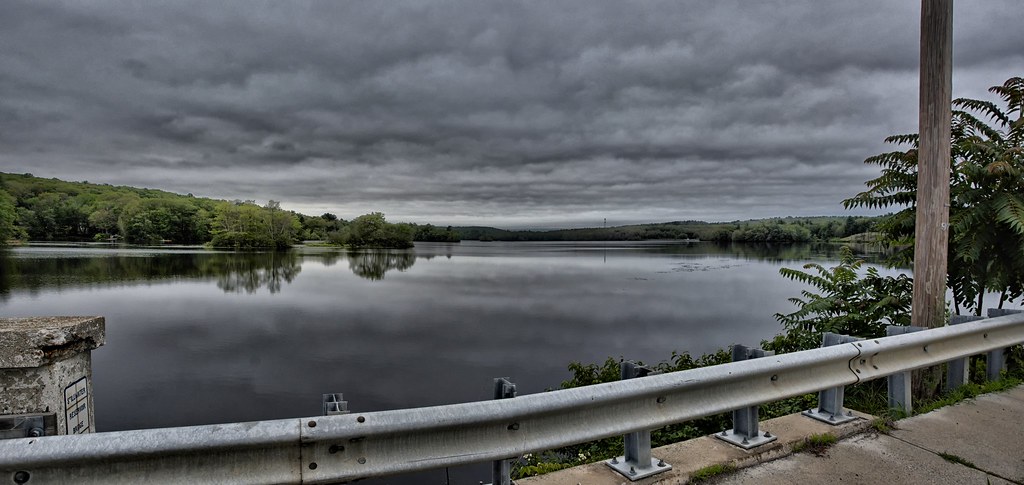
Stillwater Reservoir comes into view (R) at about 7.5 m.
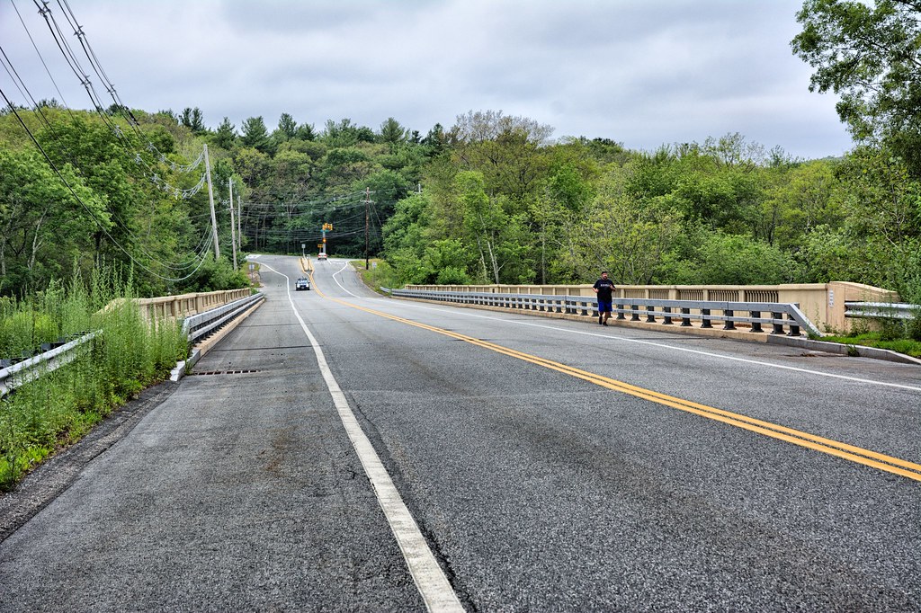
At 8.2 m. is the junction with the Washington Highway which, when the Ashton viaduct over the Blackstone River (see Tour 4C), is completed, will make an important northeast to southwest route through the State. Left a few rods, across the Stillwater Viaduct, is Washington Park, a small picnic grove with tables and fireplaces.
The Ashton Viaduct consists of 3 separate bridges. This one is called the Stillwater Viaduct over the Blackstone River. The bridge is 450 feet long and renovated in 2012. The original bridge was completed in 1933, and was built to accommodate the automobile age. When this bridge was completed it was the second largest open-spandrel concrete bridge in Rhode Island.
Yeah as the day moved along it got darker and gloomier.
From AGS
At 8.5 m. is the junction with Capron Rd. (also called Andrews Rd.).
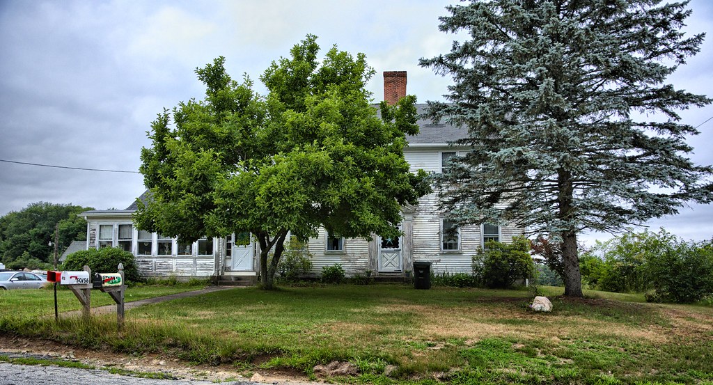
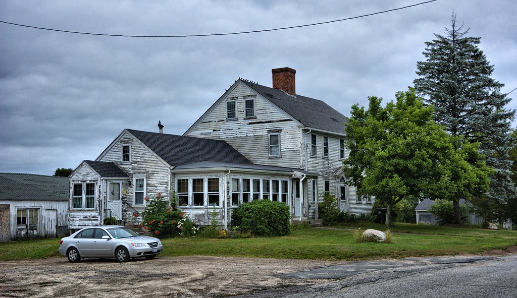
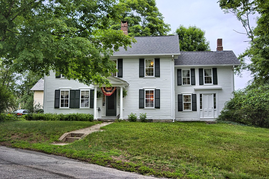
Left on Capron Rd. is at 0.5 m. the William P. Steere House (L), a two-and-onehalf-story clapboarded structure with gable roof and central chimney (about 1825). The entrance has a white paneled door, flanked by fluted pilasters and surmounted
by a pediment and a decorative fan-light. The first-floor windows are crowned with plain lintels. The house was originally on a soo-acre farm from which produce was shipped to Providence and Boston.
Why the AGS guide veered off this way, I don't have a clue. My story about this place is a couple in their 80's owns this place and once farmed it. They have kids, however, none of them wanted anything to do with farming and went off to Providence and elsewhere to work in industry. The couple no longer able to perform the tasks necessary for successful farming and are inside watching TV, looking out the window wondering what happened to their beautiful farm.
From AGS
At 0.9 m. on Capron Rd. is the junction with Stillwater Rd.
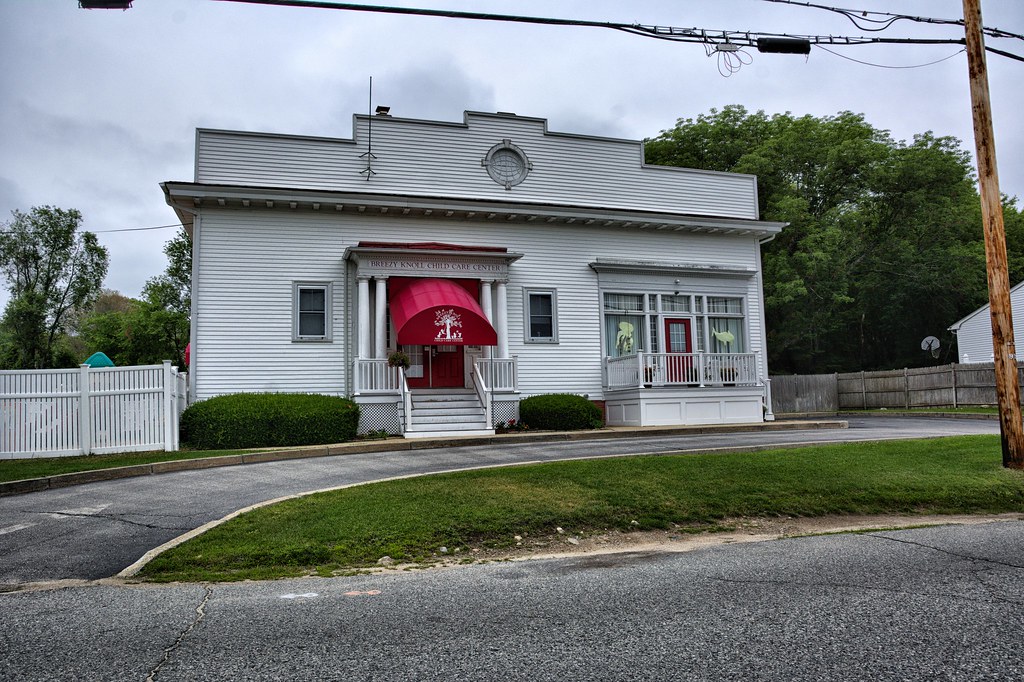
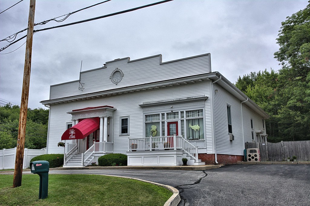
1. Left from the intersection is the center of the village of STILLWATER (alt.300; Smithfield town), 1.4 m. The village houses are well scattered over the surrounding countryside, and many of the older ones lie to the south. In the center is the Lister Worsted Company Plant (Display Room open), employing about 125 workers, which makes yarns.
Today this is the Breezy Knoll Child Care Center. It is my guess the 2 sets of doors, served as an entrance to the administrative offices of the Mill and the other entranceway to the right was to the showroom. There is a a large parcel of land across from this place, which does have some partial stone walls still standing. It appears to have been abandoned and vacant for quite a while. The area is fenced off with barb wire topping.
The factory at Stillwater was part of the Centerdale Woolen Mills by 1901, and by 1937 became part of the Lister Worsted Company. Stillwater village remained virtually unchanged during this era, its mill employing a modest number of workers (only 150 in 1939), most of whom probably resided in the village. Source: Wikipedia
From AGS
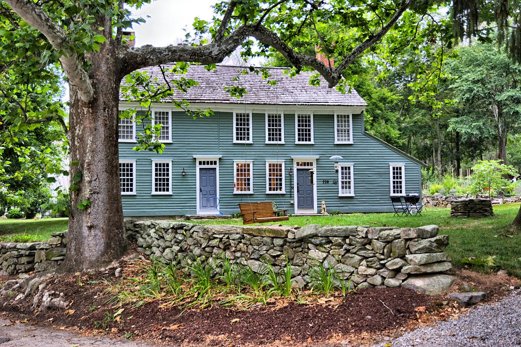
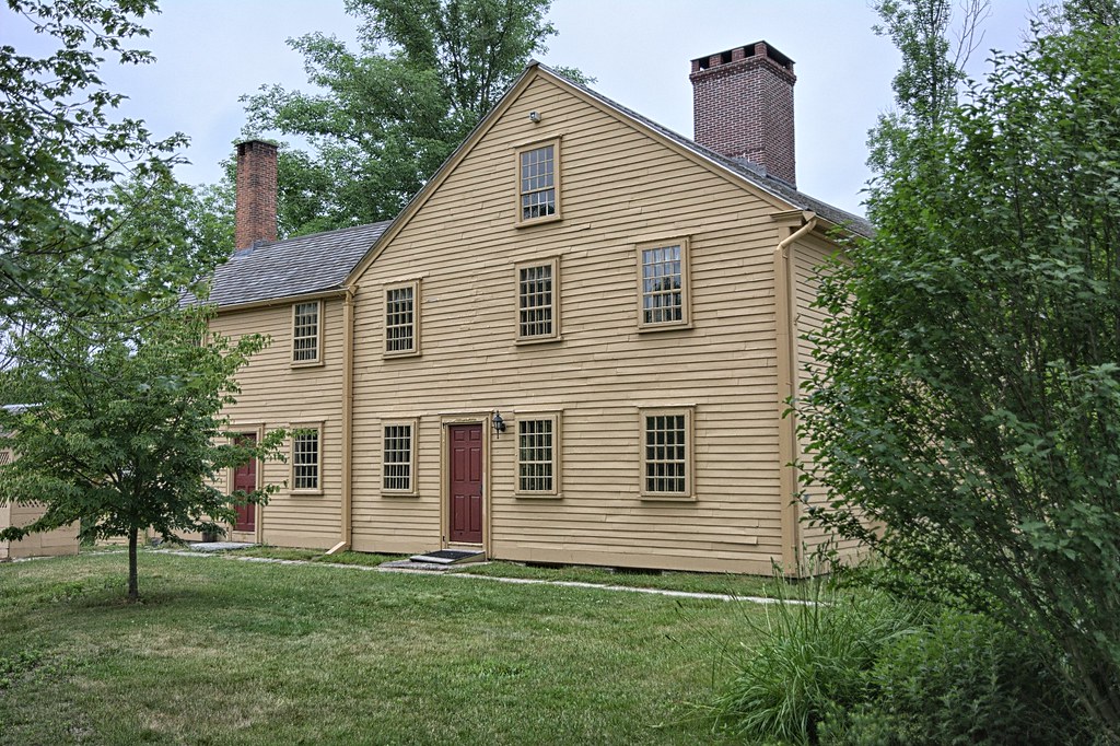
2. Right a few yards on Stillwater Rd. from the intersection is the weather-beaten yellow Appleby House (R), built in 1 736. This bulky two-and-one-half-story house, on a charming site overlooking the Woonasquatucket River, has a gable roof and central chimney. The most distinctive features of the main structure are the square plan and the gabled front. The ceilings are very low.
Today the Appleby House is now owned by the Historical Society of Smithfield. They offer tours of the house upon request.

From AGS
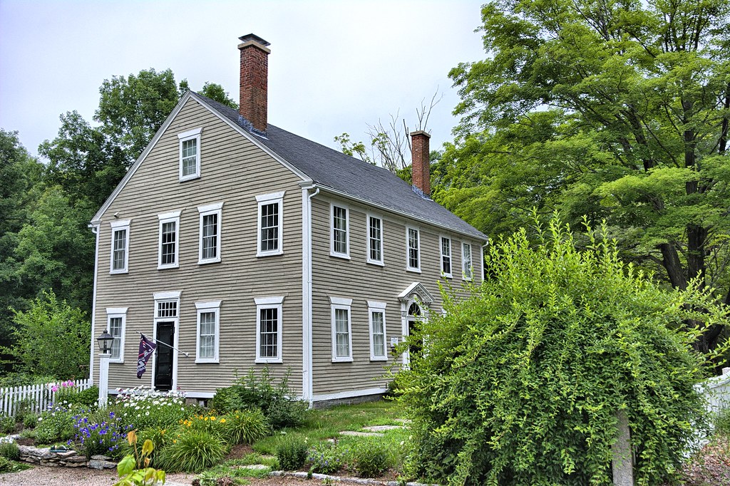
At 1.7 m. on Stillwater Rd. is the junction with Harris Rd.; left on the latter a few yards is (L) the Ainsell Angell House (1780), a large two-and-one-half-story frame structure now a tenement house. The building has many hand-hewn beams and wrought-iron latches. The design of the fan-light over the front door is similar to that of the Steere House. The delicate festooned ornaments of the fan-lights are executed in lead and the scroll keyblock over this doorway is sharply emphasized by being painted darker than the trim.
The house was built for Jonathan Angell, a farmer and wheelwright. The house stayed in the Angell family until 1854 when it was bought by Peter Ballou. The house changed hands again in 1934 and became rental property for several decades. Today it is back to a single family residence.
The next stop was the Daniel Angell Tavern, however I could not locate it for the life of me. I am assuming based on the description where it was located it no longer exists.
The Noah Farnum Homestead is inaccessible since I would have to travel up their driveway to view it. Figure I would not be that welcomed, so I skipped this one.
From AGS
At 10.1 m. is the junction with paved Old Village Rd.
Left 0.3 m. on the Old Village Rd. is the Old Baptist Church (L), a stone structure in English Gothic design, built in 1856 by the Georgiaville Evangelical Society on land donated by Zachariah Allen. It has not been used as a place of worship since 1907, and was recently remodeled for a bowling alley.
I searched and searched for this. Find out it was torn down and the site now is an apartment complex.
From AGS
Near the Baptist Church is (R) the rear of the Old Belfry Stone Mill, the original mill (1813) built by the Georgia Cotton Manufacturing Company at an 1 8-foot fall in the Woonasquatucket River. The bell and belfry are still in place on this old textile mill, which is being remodeled (1937) for a macaroni factory.
This mill was torn down in 1955 but the mill that Zachariah Allen built in 1853 is still standing. The mills have been converted to residential property. This area has remained pretty much like it was in the 1800's.
From AGS
On Whipple Rd. opposite the front of the stone mill is the John Whippie House, built in 1752 by Thomas Owen, one of the first settlers in Georgiaville. On the front lawn of this two-and-one-half-story, gray frame structure, is a beautiful buttonwood tree.
I think the buttonwood tree is gone. I actually looked this up and I don't see anything remotely like the pictures I see of buttonwood trees. When I was researching this route, I could not find anything on Whipple. What I did find was something on Thomas Owen, who did build on house on Whipple Street, who sold the house to John Farnum, who sold it to Whipple.
From AGS
The Old Toll Gate House, 10.4 m. (R), at the foot of a small decline, is a small one-story frame structure of five rooms, built in 1840 by Caleb Farnum, a descendant of the Farnums who built the pike still bearing their name.
The key to finding this place was the "at the foot of a small decline. This lead me to the Georgiaville Mill Historic District nomination form which actually had the toll house pictured. Back in the day the house had an entrance on the street, but my guess it is so close to the street, it was moved to the side. The toll house is the building on the left side of the pic.
From AGS
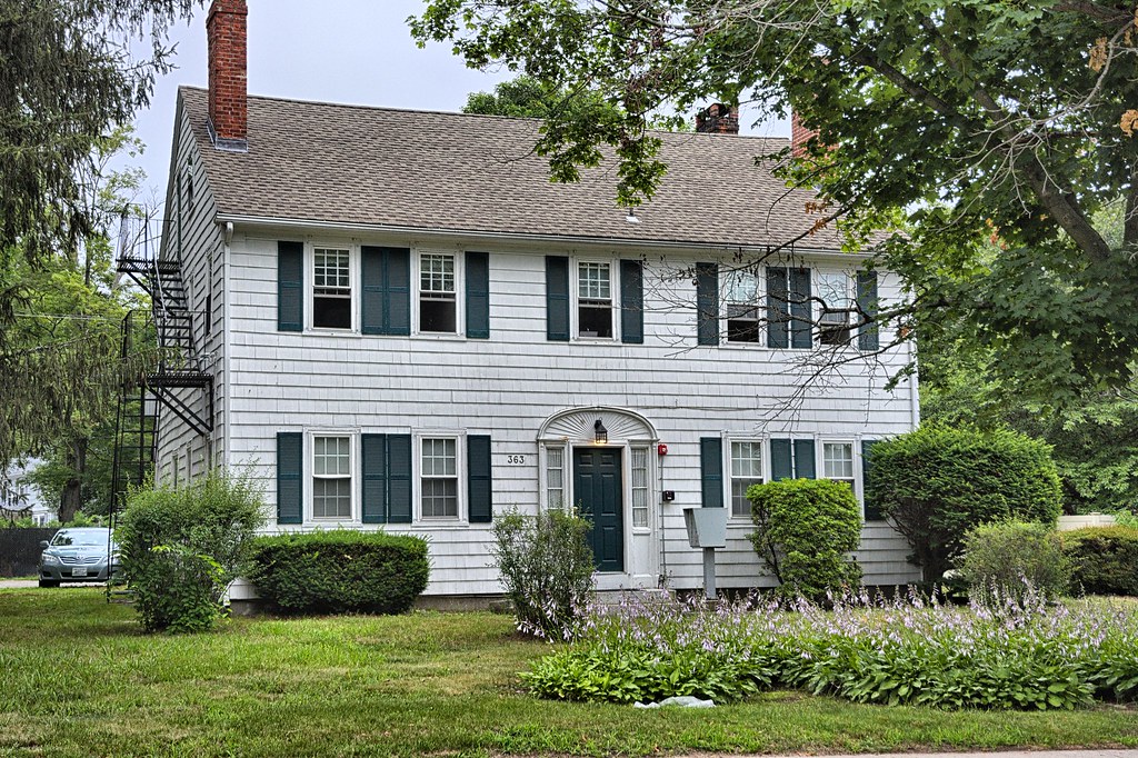
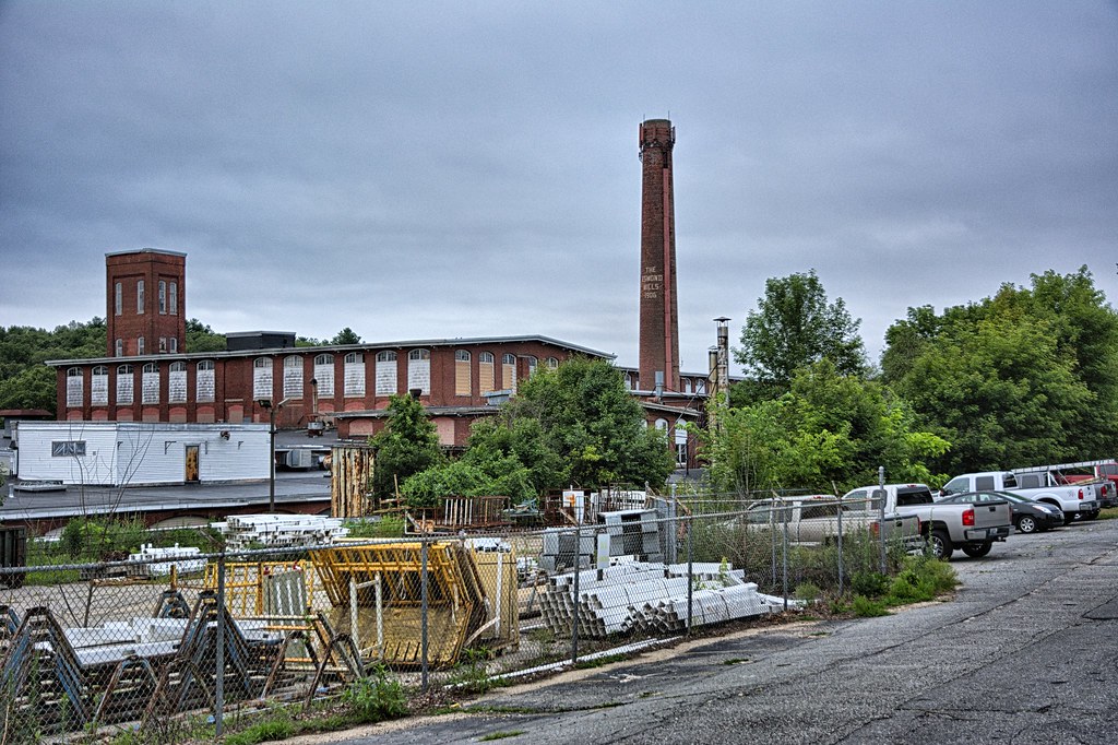
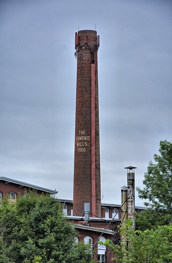
At the junction with Esmond St. is (L) the Major William Smith House (visited by permission of Esmond Mills), a large two-and-a-half-story house, built early in 1703 by the Major, one of the first settlers in the village. His extensive landholdings included the site of the modern Esmond Mills. A rear ell of the old house is now used as a State Police Barracks. The main house, with gable roof and end chimneys, has a paneled door with side-lights, surmounted by an elliptical moulding.
Nothing particularly impressive with this house, other than its age. Many people drive right passed this house and probably don't realize it was built in 1703.
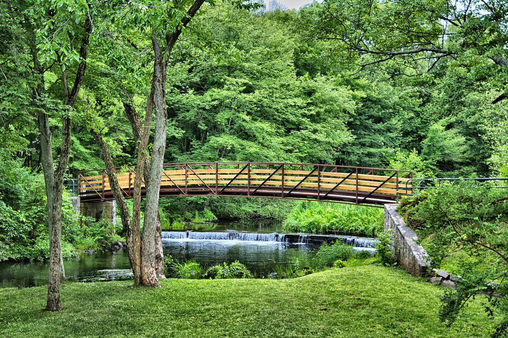
More impressive, but not on the tour, but I am throwing it in here anyways is Esmond Park. Nice setting with an arched bridge crossing the Woonasquatucket River.
From AGS
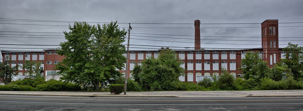
On Esmond St. near the village center is the old Allenville Mill, a twoand- a-half-story stone building with gable roof, now housing the Esmond Post Office. Governor Philip Allen (1851-53) built this mill in 1813; it is the only remaining part of a group of early textile factories. The offices of the Esmond Mills (est. 1907) (Display Room open) are across the street; this plant, employing nearly a thousand workers, manufactures the well known Esmond blankets.
The Allenville Mill is o longer a Post Office, looks more like a residence now. This is the last remaining building of this group of mills. This is not to be confused with the Esmond Mill across the street.
The Esmond Mill was built in 1907 and has various businesses occupying the buildings today. Benny's Store corporate headquarters is located in the mill.
From AGS
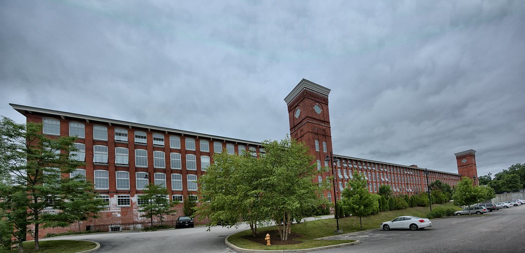
The Smithfield-North Providence boundary line is at 11.7 m. At about. 12 m. is GREYSTONE (North Providence Town); the Greystone Mills of the Joseph Benn Corporation (mohair and alpaca) are right of State 104.
The Greystone Mills have been converted to residential property. The mill and related buildings are part of the Greystone Mill Historic District, listed on the National Register of Historic Places. The first mill was constructed in 1904, with the rest completed by 1911. It was a mill developed for the wool industry. The mill shut down its operations in 1999 and was converted to lofts in 2007.

The Greystone Mill was the last stop on this tour and so ends this post.
No comments:
Post a Comment