Showing posts with label Z to A Grand Tour. Show all posts

Monday, December 30, 2013

Fifty Two Town Pickup - Lets go to the Movies

The end of the story at the beginning

I finally got around to reviewing some of the photos I took this past summer more to see what could be Waymarked. I am up to July 21 and I came across the photos I took while on a 3 day jaunt across the State of New York for the GLMC Z to A Grand Tour. This was to be one of my big pushes to turn in a respectable amount of the towns that began with Z or ended in A. We started out on one of these trips but had to turn back because MeAsWe’s neck was killing her. I took 2 vacation days from work and headed out solo, which I had not done in along time. As I was reviewing the photos 5 months after the fact, I found the beginning of the blog entry that was also started 5 months ago.

The Story as it happened

This past Sunday I took off for a 1200+ mile trek thru New York. Out to Buffalo passing over the top of the Finger Lakes and back heading east just south of the Finger Lakes. Objective was to capture as many towns that start with Z or end in A for the GLMC Z to A Grand Tour. Got plenty of the A’s but no Z’s. They just aren’t that common. I think the only opportunity was Zoar, NY but I already got Zoar, MA and you can only use a town name once. So come along as I pick up some towns and other interesting sites.

It has been so hot in MA for the last month, it has been hard to want to ride on the bike any place, at least for me. I am sure folks in Mississippi or Louisiana think that would be spring weather, however our blood has been thickened with the winters. Let’s see the Mississippians walk around in T-Shirts when it is in the 40’s

MeAsWe is not coming along this trip because she is not sure she can take the miles and constant mounting and dismounting. This kind of trip is purely RunPicandGo type trip. While scenic, it is also hectic.

The target towns and places have been waypointed. I simply cannot ride to a town a see if there is a sign of the town someplace without researching it. Google is my best friend here and street view is great. How else would I have found Laona United Methodist Church. While I have targets, I will pick up the first sign with the Town. I have learned not to pass them up. Post Offices and Welcome To Signs are not allowed.

First day is just shy of 500 miles, with 20+ targets. That is a full day, especially considering the first 160 miles is just getting to the first place. For most part I end up on the back roads, however the beginning and ending miles do involve interstates. In the beginning one is anxious to get to the first photo op and the end run, you just wanna get home. The in between is seeing New York state off the beaten path.

This is what I picked as my first photo op. A run down abandoned gas station. Nothing special, no Pure Oil 66 chimneys, no sweeping roofs as in the Phillips 88 stations, just plain ole painted cinder blocks. I promise the rest of the report will be visually more stimulating, well for the most part.

Kelts - Waterford NY Vintage Gas


First cluster is Malta, Ballston Spa, Saratoga, and Fonda, NY, oh and Niskayuna. Malta is a run of the mill diner (NY style) along with Saratoga. I have been to Ballston Spa before but never downtown. This place looks like it has a ton of historic places. Niskayuna was home to Steve Katz of Blues Project and Blood, Sweat and Tears fame.

3from_DSC_8856Set02 ES


Ballston Spa Police - Ballston Spa NY

3from_DSC_8880Set09 ES
I really like the lettering on this place. It is Art Decoish or Moderne like. I actually turned around
to go back to take a picture of this place. It is going to be along journey
Heading out to Utica next, the Garmins wanted me on I-90, but I resisted taking NY 5, which roughly follows the Erie Canal. Next town is Scotia, which I picked up the Scotia Theater. The Scotia Cinema opened in January 1929 as the Ritz Theater. “Lilac Time” was the first movie shown starring Gary Cooper and Colleen Moore.

Scotia Cinema

In Amsterdam that begins with an A but doesn't end in an A, so it doesn't count I found this VW looking for roads in all the wrong places.

VW on top of a Smokestack

As I head out to the next town all I could think of is the Chicago 7, motorcycle movies and cowboys.


3from_DSC_8895Set14 ES

I grabbed the Bank of Utica as the A town, but really is very uninteresting, however the name Utica was easily photoed. Right across the street is the Savings Bank of Utica known as the Gold Dome Bank. While a bit gaudy, it really is beautiful. This is a great example of American Beaux Arts which became the style du jour after the Chicago's World Fair in 1893. The bank was built in 1900.

Savings Bank of Utica

Savings Bank of Utica

Savings Bank of Utica


Note a dramatic as the bank, never the less a flashback to the past. The Stanley Theater is also located in Utica. It opened in 1928 and has an affliation with Warner Bros. Pictures thru out its history. It is on the National Register of Historic Places.

As I head furthere west I had targeted Verona, NY as an Z to A town. While I had a couple of choices with the name Verona, this old hotel just seemed so kewl. It has no significance other that the NEON lights to me.

Verona Hotel - Verona NY


Not to far from Verona is Oneida NY. I have been here a couple of times, once specifically to pick up the home where there was a utopian society lived and made silverware. This place was just so bright and had some elements of Googie architecture.

Christopher's - Oneida, NY

New York is suppose to be semi known for their diners, but today it is movie theaters. The Kallet was built in 1937 and is a great example of Art Deco, more specifically Art Moderne.

Kallet Theater - Oneida NY

Just outside of Syracuse is Canastota. I picked up a RR bridge for the Z to A town, but had to stop for the old Methodist Church that was built in 1910. It has been subsequently converted to a restaurant / function place called the Greystone Castle.

Canastota Methodist Church - Canastota NY

Keeping with the Movie theme grabbed the Palace Theater in Syracuse. This theater has been owned and operated by the same family since 1922 when it was built.

The Palace Theater - Syracuse NY

Making some tracks I passed over the top of the Finger Lakes and stopped into Canandaigua NY. Grabbed the really neat Town Hall for the Z to A tour and walked up the street for the court house.

Canandaigua Historic District - Canandaigua NY

Canandaigua Historic District - Canandaigua NY

It is getting late in the day and I still have a bunch of miles to go. While I am not running out of sunlight yet, there is not a lot of day left even on July 21. Pulled into Honeoye Falls NY, snapped a quick shot of the Historic District and headed further west.

Masonic Temple Building Honeoye Falls NY

1886 - Village Hall - Honeoye Falls NY

3from_DSC_9054Set63 E

Passed thru Henrietta NY and made my way to Scottsville and stopped for an artistic shot of this barn. The view I had was much better than what I translated it too thru the camera.

Sundown in Scottsville NY

Only a couple more town to go before I sleep. So far I have not seen any deer.

Town of Caledonia Town Hall

My destination for the night is Batavia, NY. Don't have a clue where I am going to stay so at my last stop of the night, I called MeAsWe to let her know I am still upright and not cohorting around with the antler folks. Cell phone is running on empty, FJR may be getting there too so MeAsWe finds me a place in Bativia and I pull into town just a little while after the sun has gone to bed for the night.

Elba Diner

When I look at the map where Elba is in relation to Scottsville and Batavia, I see that Elba may not have been exactly on the way to Batavia. I elected to get Batavia Z to A capture tomorrow morning.

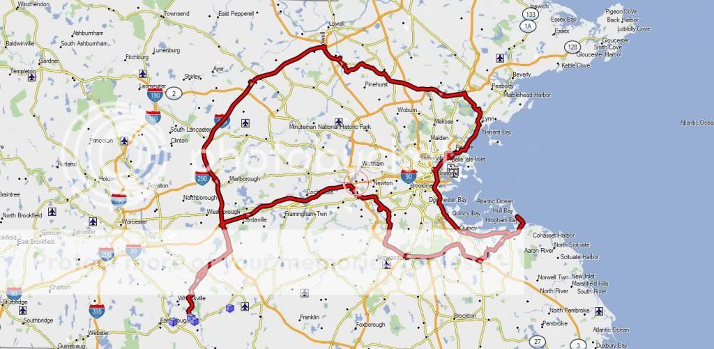
Today's route

T 2013 07 21

Sunday, May 19, 2013

Mounting Ida, Carousing with Chelsea, Wooing Wyoma

Another one of those days. Do I head for Zoar for a Z town or head toward Boston for some A towns. MeAsWe is hmmm hawing about going. She is trying to decide on the ride or yard work. I went back to create 2 routes, one heading west, one heading east. Said to MeAsWe, I'll give ya 10 miuntes to figure it out. She opted for the yard work. Can you believe it !!!????!!!. With that said I figured I might as well hit the Boston route.

So why would anybody pick a route toward Boston. While there are some very nice scenic roads inside the 128 belt, this was going to be city riding. So why ? Because there are towns that end in A that way. The agenda today is a relatively a short list. Mount Ida, Kenberma, Chelsea, Wyoma, Billerica and North Billerica.  Camp Nashoba is on the list, but a soft hit. Usually there are 25 or so places we hit in a day, today is gonna be a leisure ride.

There are 2 ways to run Grand Tours like this one. Just head for the location and find a sign with the name on it or target a specific place to capture. I usually (98% of the time) target my places so I know there will be a sign there. Fire stations, police stations, city halls, libraries are all good bets. Libraries are not as good because people have a tendency to etch someone's name in stone on them because of some donation or contribution to the town. I use Google Maps to find the town, then search for the town name to find specific targets, then try to use street view to see the signs. Yes alot of work but my success rate is pretty high. 50% of the time while riding into the town I fnd a sign that will work and just pick that up.

Originally I had my self heading to Mount Ida via city streets. I got a late start, so I bring up Mount Ida College in the favorites, request the  fastest route and hop on the Mass Pike. This will be the only interstate until the end of the day.

At Mount Ida College I pass the guard shack. I did stop, but the guard simply nodded and rode in looking for a good sign. Right at the entrance was a good sign, but I figure I got plenty of time I would have to ride around the campus. Pretty deserted. Didn't have to stop once for students crossing the street. Either they are in the dorm rooms studying or getting over a hangover. It is Sunday. Found one banner right outside the athletic field, which is the only place that shows any life. Opted for the sign at the entrance.

All photos are clickable and will enlarge for a more complete experience


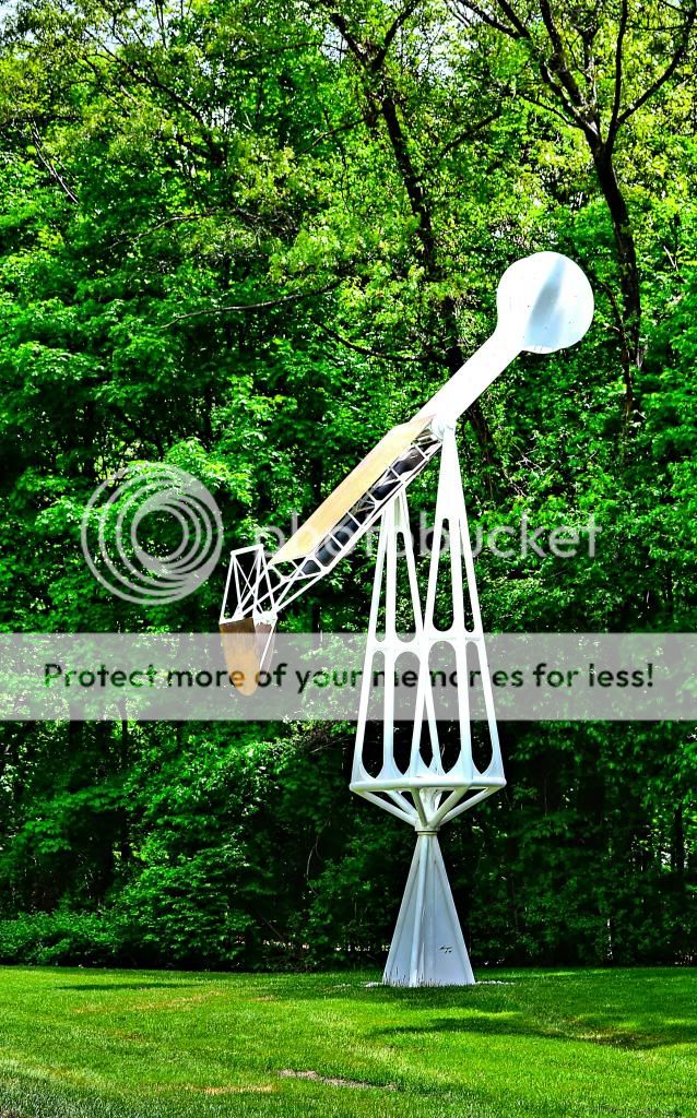
Not sure what this is, maybe a perpetual oil rig, water pump, pumpkin thrower, thing for hurling tar at the warring attackers, or simply a piece of art.


Next stop is Kenberma. Stopped along the way to take some photos of stuff.

Passing thru Weymouth I just had to stop for this school. It was so bold and bright. Maybe why the place is called Stars. Jefferson School was built in 1889, which reflects Queen Anne (Victorian Age) architecture. This place has numerous waymarking category opportunities, clock, dated building, on the National Register of Historic Places, and a couple more I am missing


I passed these bikes in Hingham, MA and actually turned around to go back and take pictures of them. It was not because there was anything special about the bikes, it was the colors that caught my eye.


Hingham is full of historic buildings and need to come back here with a list of places. It was settled in 1633 and incorportated the next year. History lesson over.  Right about here on, the breeze kicked up and the temps dropped. While I was not freezing, I did get to see how meshy my new riding suit was. Plenty of air was flowing thru it.

Hull is on Nantasket Penisula  , so you get the wind from both sides. My destination is Kenberma  a town neighborhood of Hull. The creator of Napstar (remember them) spent alot of time in Hull.


Before I got into Hull proper, I stopped here for this wonderful panoramic vista. It was much better coming out of the my eyes than my interpretation with a camera.


The bath house at Nantasket State Reservation is a really neat Art Deco building built in 1930. 


MeAsWe and I came here a couple of years ago specifically to get the Massachusetts State Park Passport Stamp. The box had been smashed to pieces and the stamp was gone. This time the box was intact with the padlock on it. In the passport book they provide the combo. One problem, the salt air had welded the tumblers to the lock body and they would not spin. Not to be deterred, I walked back to the bike and got my handy four in one screw driver. I tried to force one of the tumblers but all I did was jam the screwdriver into  my hand and make it bleed. I looked at the lock, the hinge, looked up to see if there was anybody official looking and then flipped the phillips head bit in the screwdriver and unscrewed the three screws that held the hinge to the box, reached in got the stamp, stamped my book, and screwed the hinge back onto the box. Mission accomplished.


On the way into Hull I passed this joint. Parked the bike, dismounted and asked the 3 guys if the dogs were any good (as I was pointing the joint), to which they said, not bad if they were open. Being off the bike figured I might as well take some pictures of Massachusestts Bay. The 3 gents were riders so of course the conversation got around to bikes. One guy had the premo spot on the wall where he could lean his back against the railing.  Perfect for those really hot days to watch the young girls all oiled up struttin their stuff. This was not one of those days, but he was saving the spot.


Back into Hull, thru Hingham and meandered up 3A toward Quincy along the coast. Brrr it was breezy and chilly.

In North Weymouth caught this out of the corner of my eye and went back for a pic. This is an old Cities Services gas station built in 1928. The section that juts out was actually a portico that you could drive you car under. Cities Services is now CITGO. I stopped for a few more pics on the way. At this rate I am never gonna get to my next stop.


Some how I got rooted up onto 93 (bad routing on my part) (and I lied at the beginning about interstates)(actually I forgot) and found myself stuck in traffic with the wind whipping, the mist cooling the air even more than it was and no where to pull over to put a jacket on. It was nice finally to hit the tunnel, it smelled of fumes but it was warm. For that moment warm was more desirable than fresh air.

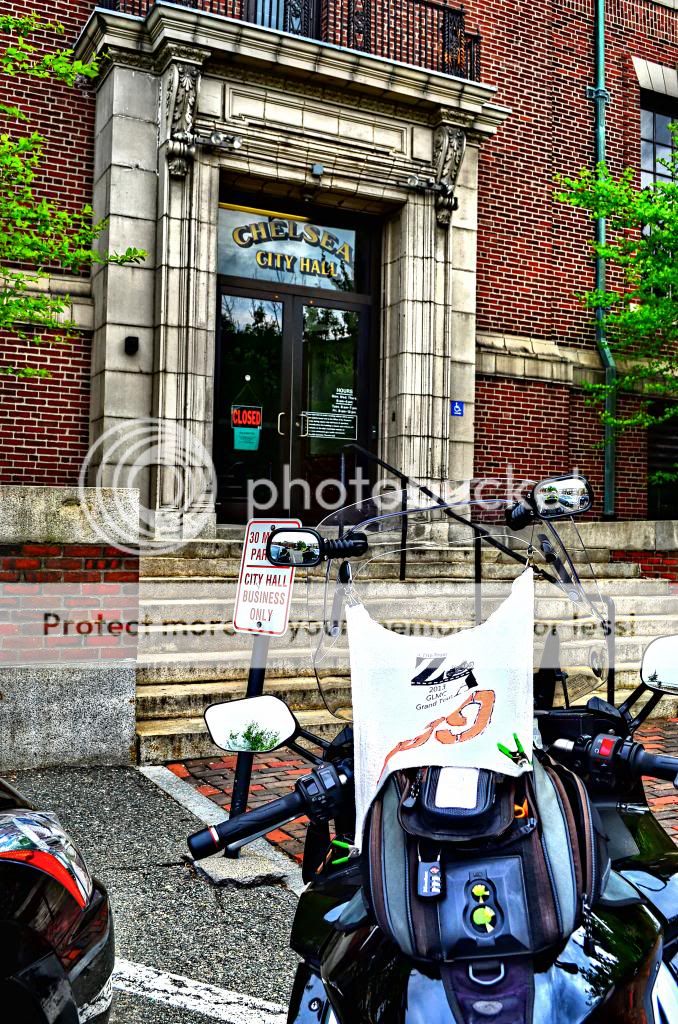
Thru Boston and over the Tobin Bridge. My exit was 4th street, but it came up so fast, it looked like a turnout out not an exit, I missed it. Not a big problem in term of miles it cost me maybe 2 extra miles, but in city traffic that is like 20 miles of forest rat infested roads, except the forest rats are made of metal, have four pieces of rubber instead of legs, but are just as unpredictable. Arrived at Chelsea City Hall and grabbed a couple of pictures.


At this point the sky had a serious deep gray tone to it, the kind that water pours out of, and considered heading home. Wyoma is so close. Now if you are not from Mass, Wyoma means nothing to you. If you are from Massachusetts, I bet most are saying where the heck is Wyoma. I found it and targetted 2 places, the True Hardware, and the Dairy Twirl. The Dairy Twirl is on a trafficitty road with no place to dismount, so I pulled right up on the sidewalk. Between the Dairy Twirl and the street was a guardrail so I had to stand in the street to get the shot, at least the bike was protected.


While I was taking the picture a car stopped and asked me what the heck I was doing. My answer I needed to come to Wyoma and take a picture with my flag. They both laughed and continued on.

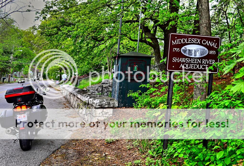
While on route I crossed over this bridge, got a quick glance of a stone structure to my right. At the next street I made a U turn and headed back. What really caught my eye was a little plaque in the structure that looked like the plagues to designate a Civil Engineering Landmarks. Sure enough this was part of the Middlesex Canal built in 1794 and completed in 1802. The Middlesex Canal connected the Merrimac River in  Lowell, MA to Boston Harbor. The canal was  the first to use hydraulic cement.


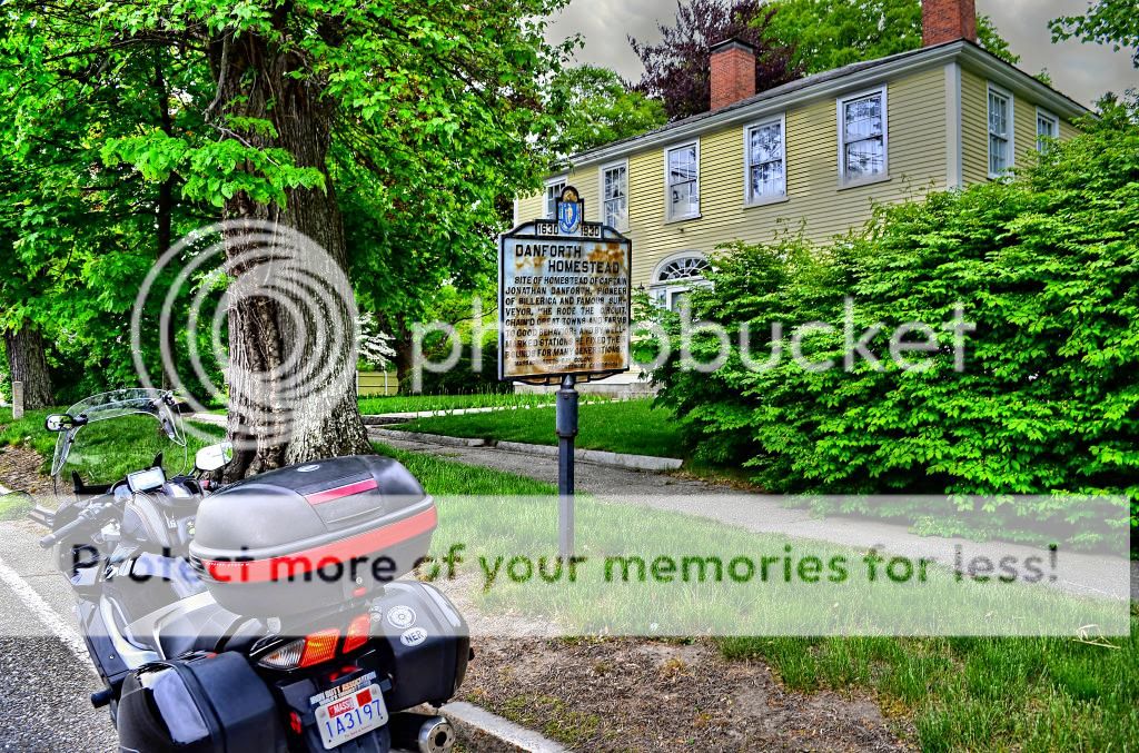
Not even to my next destination and the clouds are still darkening, I just couldn't resist stopping for this. I almost have the complete collection of the New Hampshire markers and  I have been doing a pretty good job of knocking these off as well. Of course this is on the NRHP and good for waymarking.


Skies haven't lightened up, matter of fact they were a tad more ominous. Billerica is on the way home. Picked up Bellerica High School and headed for North Billerica Baptist Church. It was the only thing that came up North Billerica in Google. Not knowing really where I was, I thought it was unusual I was routed onto US 3 North. Now that I look at a map I realize I am inside the 495 belt and this was on the way home. Felt a couple of drops.


Grabbed the needed picture of the church and realized it was well over 100 years old and qualifies for a waymark in the category of This Old Church and will also qualify as a Baptist Church and probably on the NRHP. Walked around and took a bunch of pictures of not only the church but a couple of the houses that I thought would be historic places too.


All targets but one have been captured, the next stop is Camp Nashoba. This is a real iffy place. I don't have a clue if there will be a sign there. Hopped on I-495, headed south and the rain began. I am 50+ miles out and opted to get Camp Nashoba another time, if at all.

All in all I had a great ride. Lots of urban streets with plenty to see, some coast line with their  panaromic vistas, and county type roads once I headed out of Wyoma. The ride had a little bit of everything, but most of all it was a ride without incident, matter of fact not any thing I would call a close call, not even a horn.