Sunday, January 20, 2013

Looking for Locks in all the Wrong Places

Long weekend, cabin fever starting to set in, have avoided the flu thus far. The winter season is bad enough without riding, couple that with my need to chase stuff, it is abit over the top. I choose not to ride in the winter, not due to temperature, but black ice. A new vehicle is all I need to chase stuff. Today I am going cave man and gonna ped it. Yup gonna use my feet, both of them. (please click the pictures to see them full size)

Yesterday I re-visited Blackstone, MA to pick up the Blackstone Viaduct for waymarking. Waymarking is a place to log places you have visited by category. They have well over 1000 categories and I specialize in National Historic Places. Today's quest is for the Blackstone Canal Historic District. This cover 8 towns and I am doing Millville today.

The Blackstone Canal is pretty hard to document with photos, since much of the canal is way off the beaten path or simply no longer visible. With a bit of research, you see the trenches off to the side of roads and the river, you find these are part of the canal.

The Canal was built between 1825 and 1828, covered 47.5 miles between Worcester and Providence, and closed in 1848. The trains came and made it obsolete.

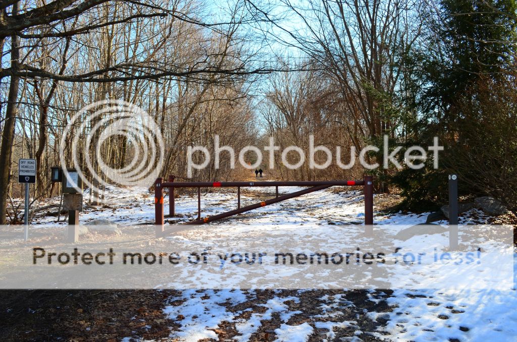
Around 10:30am I pull up to the Millville Lock #21 parking lot. There a few cars and people getting back into their cars. My guess they just finished a walk down the Southern New England Trunkline Trail.


I see another couple get out of their car, and I immediately head towards them, saying "Excuse me, Do you know how far the Millville Lock is". The guys says "About  a  mile from here" I have no clue how far a mile is any more. Back in the day, and I mean day, walking a mile, swimming a mile, was nothing. I just assumed it would be true today.
 
So I head out. Theres the couple that told me how far the canal was.
 
 
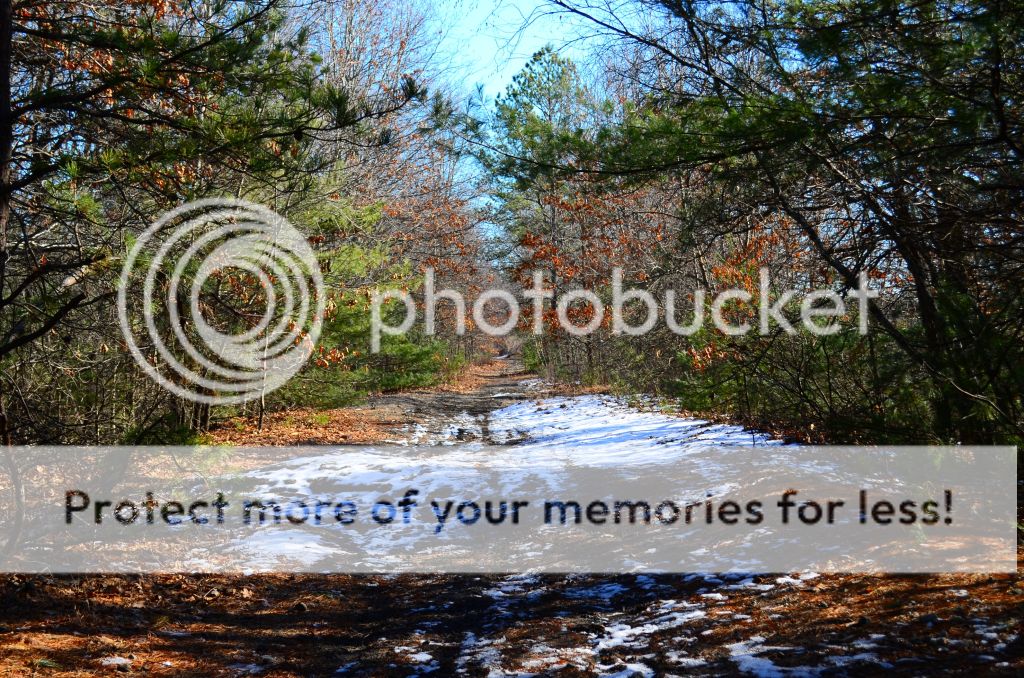
And walk some more and more
 
 
Finally see pay dirt
 
 
When I get to the edge I am saying to myself, "This doesn't look like the canal lock I have seen in the pictures. It just a bunch of train bridges".
 
 
If you look just to the right of the bridge, you can see a structure. I am saying to myself, that can't be. What are we suppose to cross the bridge. For a moment I actually thought about venturing out of the iron beams. They looked wide enough to walk across. Good thing I gave up that idea.
 
Then I said to myself, maybe the locks are down at the bottom and I just can't see them from here. Both sides kinda of look liked they had a pathway down to them. Without regard for my age, physical well being (or should that be pitiful bad being) and abilities, I started the descent.
 
This was not a gentle descent, this was an old railroad track bed that crosses a river. The pitch had to be 60 degrees, lots of leaves, mud and snow. Once false move, one slight trip and I would have found myself at the bottom lickety split.
 
At the bottom I was greeted with prickly bush limbs that were grabbing a hold of my clothes and trying to rip them off. No canal lock down here. Might as well take some pictures
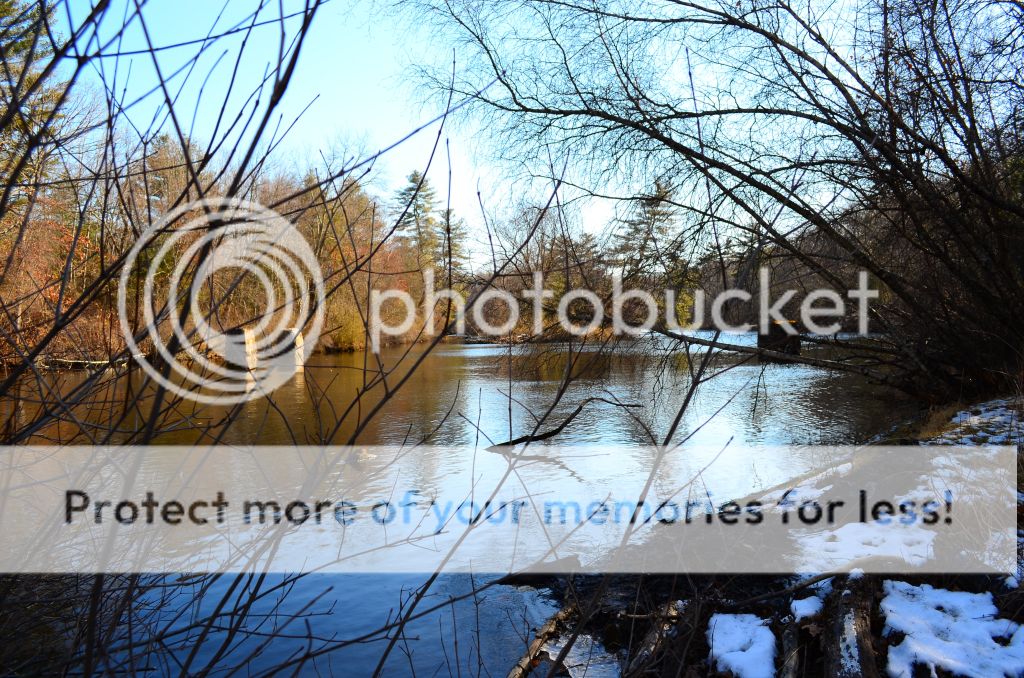


As they say what comes down, must go up. Well that might not what Newton had in mind, but for me I had to get back to the top. There just was no way I was gonna bushwack my way back to the parking lot.
 
When I looked at the challenge in front of me and fighting off the prickly bushes some more, I realized I should have given some more thought to making this descent. This is the embankment, which is how I have to go back up.
 
 
Let's just say the climb back up was not at all pretty. Like the descent, once false move, one loose tree branch I was grabbing on, or just a moment of loss of footing, I would fnd myself back at the bottom with the prickly bushes. Only difference would be, this would be akin to a back flip, with a twist, degree of difficulty 3.0.
 
I make it to the top and my lungs about to explode. My heart I didn't even feel it, it probably died on the way up or the lungs covered masked the sound. Still haven't recovered from the three pack a day habit from 12 years ago. Sitting for awhile would be a good thing. I could review where I have been, where I need to go and just take in the cool crisp air of a winter day. At least now I have a perception how far a mile is.
 
I did start to wonder, what if I had a heart attack. I did have the cell phone and I could call MeAsWe ( I did invite her, but she declined), I had my hand held GPS, I could give her the coordinates and maybe make the news that night. Enough of that.
 
The walk back was pretty much like the walk to get here. Matter of fact it was exactly the same. It just doesn't look as green and colorful as getting there.
 
 
Off in the distance I see movement. It is a truck and I realize I am almost to the parking lot. What a welcomed sight this was. I felt like Merriweather Lewis however I did discover the Northwest Passage, whereas the two did not.
 
 
If you look to the right of the gate you can make out something that looks like a stand. There are maps in there. I pull one, sit down at the picnic table and realize I was not at the Millville Lock, but at the Triad Bridges. I can't believe that couple led me astray. They probably walk this every weekend together to stay fit, but they don't have a clue about the history of what they are walking. How do you ask, "How far is the Millville Lock" and then immediately follow up with "Are you positive".
 
The map indicates that the Millville lock is about half way down the trail I went and the hooks off to the left. There was a Millville officer sitting at the head of the parking lot. I walked over to him and confirmed what I had learned. He said if you head down Hope Street, it is just off there a little bit.. He also said, "I don't know if you can get in that way, there are private residences back there".
 
I thanked him and as I was walking away, thinking, when did obstacles ever stop me.  I walked from the Blue Flag to the Square 003.  Just above it you can see Hope St. I drove to the end of the street.
 
 
There were 2 guys outside, at the last house on the street, working on a car. I asked them if they knew where the Millville Lock was. One of the guys leads me into his back yard and points down to into the gully, "You can see the stones from here through the trees. It's just down there"
 
I didn't come this far not to get a picture of the lock.
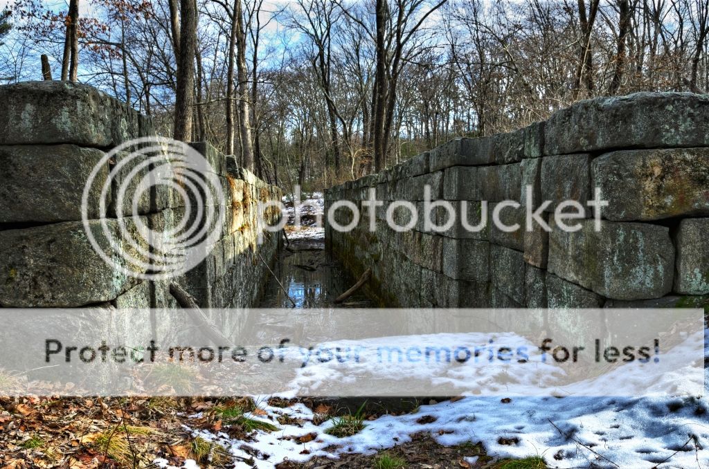


All for a picture for something I chased. It's a hard habit to break.


Sunday, December 30, 2012

Taking 5 for BBQ

One final year end wrap up item. Smoke Chasing 2012 just announced the results for all of us fools running around the country taking pictures of BBQ joints. Over the last 2 years there have 500+ entrants to this Grand Tour. This year there were 50 riders that completed the minimum joint runs. Out of the 50 only 7 of us completed the Dave Morrow 15 /15/ 15 challenge. This challenge was traveling to 15 states in 15 days to 15 joints. Kansas was a mandatory state in this challenge.

We scored the 5th highest points in this tour. Click HERE to see the joints we visited.

Thursday, December 6, 2012

The People Downstairs

We recently moved out of a 3rd floor apartment into a small house. Of course my son, Sky,came with us and even brought his girlfriend with him. While we were living at the 3 decker, the people on the second floor would send their 10 year daughter upstairs to tell (not ask btw) us to turn down the TV. Me being kinda of heard of hearing tends to listen to the TV a tad louder than most folks. Matter of fact they once called the Uxbridge Police to pay us a visit to turn the TV down.

We were watching a movie last night, The Strat Pack. MeAsWe said my phone was ringing. Who the heck is calling at 10pm. Get up, get the phone and see Sky called us. I called him back and he says can we turn the TV  down, he is trying to get some sleep.

My son has turned into the people downstairs. We just might have to move again.

Sunday, December 2, 2012

Sweet 16

One of the New England Rider forums poster asked the question, "What constitutes a ride ? Does riding to Dunkin Donuts 6 miles away really a ride ? "

I don't know the answer to the question, however I did make a reference to going out simply to grab a TAG, which is not a whole lot different than riding to DD. For most, riding to DD makes more sense than going to get a sign with a 16 on it. For me the Sweet 16 is much better than an over rated DD coffee.

Paper, Rags and Swag

Some tidying up for the season.

Tour of Honor Certificate


10th place for me and 11th for MeAsWe in GLMC Grand Tour. There were a total of 118 participants. This thing is getting more and more competitive each year.


Some swag from the GLMC Tour


Saturday, November 24, 2012

Taggin Along in Rhody

Haven't been out in awhile. Thought about changing the oil for the winter setup, but was too lazy to do that. All the tours have ended and I am really not one to ride around solo aimlessly, so today will be about getting tags. MA tag is up in Gloucester, CT tag is down around New London, neither is that far away but I am getting a late start and just feel like stretching the legs abit.

I lined up the 1,2,3 tag which is a progressive numbering one. The last number was 13 so 14 is up on deck. You have to find the number 14 someplace. The Rhode Island tag is the Providence Zen Center which is not in Providence. Theme tag is finding a BBQ Joint. This shouldn't be a problem since I have almost every BBQ place catalogued from Smoke Chasing. The last one is the Last letter is the first Letter tag. The letter T is in the spotlight.

Loaded up the GPS with some potential spots. Also bringing along my Etrex to capture my walking track. I found a piece of software, GeoSetter, which marks the GPS coordinates into the photo EXIF data by comparing the time data from the photo and and GPS tracks. This is actually a pretty neat piece of software. Best of all it is free. Once you have it in the EXIF data you when you view the data in something like IrfanView, you have the option of seeing it in Google Maps or see it via a GeoHack link which presents a ton of optional mapping locations.

Picked up the T for the Last Letter First Letter someplace in Pawtucket. Actually I know exactly where it is via the Geo Tracker (N41 52.380 W71 24.411)


Next shot was right down the street from the Toys for Tots. I figured I would get a 15 in case I got bruced on the 14 tag.


Next stop I never used in the tagging games, It was my intention to send folks here, but I used a different shot. Still was a nice spot for the day. I drover right up on the sidewalk for this shot.  There were a couple of bus drivers exchanging buses at this location. My guess it was a shift change or something, They never even blinked an eye.

These were taken Slater's Mill is a National Historic Landmark in Pawtucket, RI. The mill in the first picture is Wilkinson Mill built in 1810 next to Slater's Mill. Slater's Mill can be seen to the right, it is yellow with the cupola.


The church in the background is the Temple of Restoration. The dam is located on the Blackstone River. Right across the street from Slater's Mill you can get some INK (National Park Stamp) in the visitor center.


Right around the corner is McCoy Stadium, which is a go to Tag. McCoy is the minor league stadium for the Red Sox's. Life for the stadium began in 1938 and was completed in 1942. I have been to a few games here and it is a pleasure coming here versus Fenway. Fenway may have the nostalgia, history and the Pros's built you have to put up with the traffic, crowds, parking and expense. Box seats at McCoy are $12.


This is the tag photo at McCoy. The new theme tag is a Memorial to a person in Sports. The statue is of Ben Mondor the owner of the Pawtucker Red Sox.  


Making good time I headed for Boneyard Barbecue in Attleboro, MA. I have been here before but did not eat here. I would grab the Theme Tag picture and have some chili. Perfect day for Chili since the temps has not gotten above 48.


The food


My company during lunch


Up to this point I had not seen any 14's and was beginning to worry I would not come across one before I got home. I figured I could always get a house with a 14 on it, but that seemed a bit cheesy. Before reaching nirvana I grabbed this along the way just in case.


It must have been Karma, because not too far away was American Legion Post 14.
 
 
What I posted for the tag for fun. The 14 really showed up on this one thou.


My last stop was the Providence Zen Center in Cumberland, RI for the Rhode Island Tag. The Providence Zen Center is a Buddhist Monastery and Retreat Center.


Of course I had to post this with some interpretative stream of conscious and a reference back to the 60's.


It's about 3pm and I decide to call MeAsWe. No answer, so I called Sky, my son. I get him to log onto GLMC for their tag. I forgot to look this up before I left, It was a full size lighthouse. No problem for us New Englanders, however given the time of day, temps now in the low 40's I simply wasn't gonna chase one down. Looking at my notes, I was confused at what was the Theme Tag. Sky looked it up and said it was a town bordering another state. OSJ had bruced me on the BBQ joint. In Rhode Island heading for home this would not be a problem.
 
Crossed into Mass, do a Uey and grabbed the last photo of the day.
 
 
Not alot of miles, just under 64 miles, but it felt good to get out and chase some stuff


Wednesday, November 14, 2012

Motorcycle Calendar for 2012

My previous post for a calendar was for Scenic shots taken during 2012. In the past I have usually only made one calendar, essentially combining the scenic and pictures with motorcycles. This year I decided to create two calendars. MeAsWe is a calendar user and relies on keeping track of various dates with our calendars. Me, I create them purely to see what a collection of blowup pictures would look like and Cafe Press offers a reasonably priced solution with their over sized calendars (11X17). None of the photos were specific to a month and placement was essentially in the order they were on my computer, thus I never intended the picture to relate to the season or month.

Please click the photos to enlarge


The Cover
This ends up as the least looked at picture of the group. Once you hang the calendar up this gets turned over and the monthly ones are displayed. I essentially copy various sections out our our photos thru out the year and pasted them into a new canvas. The collage has a little bit of everything from the weird stuff we saw, the historical places, memorials for the Tour of Honor, BBQ joints for Smoke Chasing, towns for the USA Tour, and National Parks we visited.


This was shot in Jamestown, RI. The bridge in the background is the Clairborne Pell Bridge the drops you into the Newport RI. This was one of the first good riding days of 2012, March 18th. I remember I was in a private driveway / parking lot for condos overlooking Narragansett Bay. I had to be quite a sight since I was laying on the ground to take the pictures. Some folks did pull in, gave me a strange look, but never asked if everything was ok. Here you have an old guy, lying on the ground, squirming around. I could have been having a heart attack for cripes sake.


A targeted town for the GLMC USA Tour in South Carolina. This was a major branch off of our overall route. We picked up the Sheldon Old Church ruins, which was historical and neat. In Autryville which was another USA capture, there was some neat painted signs on the side of buildings that looked like they were from the 50's. 
 
An update on this photo. Cafe Press will not permit me to use this photo, since they feel it is violating Coca Cola's trademark. 


This was our turn around point in Fort Scott, KS. To complete one of the side dishes for Smoke Chasing 2012, you had to include the state of Kansas. The BBQ here was top notch and I would not hestitate coming back here for lunch again. 
 
 
Taken just outside of Mammoth Cave in Kentucky. I am not sure this picture is going to turn out great in full size. We just liked it because of the dichotomy between the carriage and the FJR. It was a quick shot, since the carriage was moving. Right after this shot, we were almost taken out by a car who thought they were the only ones on the roads and was using up the whole road. It was quite the pucker moment.


This is the original bridge the crossed the New River at Canyon Rim in West Virginia. The trip down into the gorge is about 8 miles and well worth the trip. I don't have a clue how the trucks made it across the river with the twisty roads.


This is the fountain and entrance to Weston State Hospital, also known as the Trans Allegheny Lunatic Asylum. It is the largest hand cut stone building in the US and second only to the Kremlin in Russia. The hospital has been designated a National Historic Landmark and located in Weston, WV.


Taken in Hampton, NH on RT 1A. We had just finished breakfast.


Taken in Bucksport, ME on the Penobscot River. If you would turn yourself to the left you would have a great view of Fort Knox and the Penobscot Bridge.


We got up at 4:30am to catch the sunrise at Searsport, ME. My first attempt at a sunrise.


I call this Tina and a FJR. Out chasing USA towns, BBQ Joints and came across this waterfall in Fitchburg, MA


This was taken at my friends shop in Whitinsville, MA. I usually go here on Saturday mornings to talk cycles, politics, books and getting older. A kewl place to hang out. 


Taken at Stoggy Hollow General Store in Woodstock, CT.  It was a great ride for 75% of day. The last 25% poured buckets and the temps dropped quickly. 


This is in Skipwith, VA. I planned this top for the USA Tour. On MapSource this looked like a small diversion, you know an on and off the road. While we were not in a hurry, this proved to be more than a small on and off trip. Nice country thou. This is the replacement for the Salemburg Grill above.