Monday, May 26, 2014

I Knew It I Knew It I KNEW IT


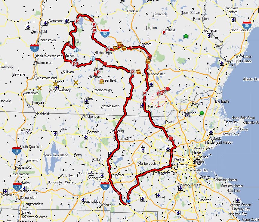
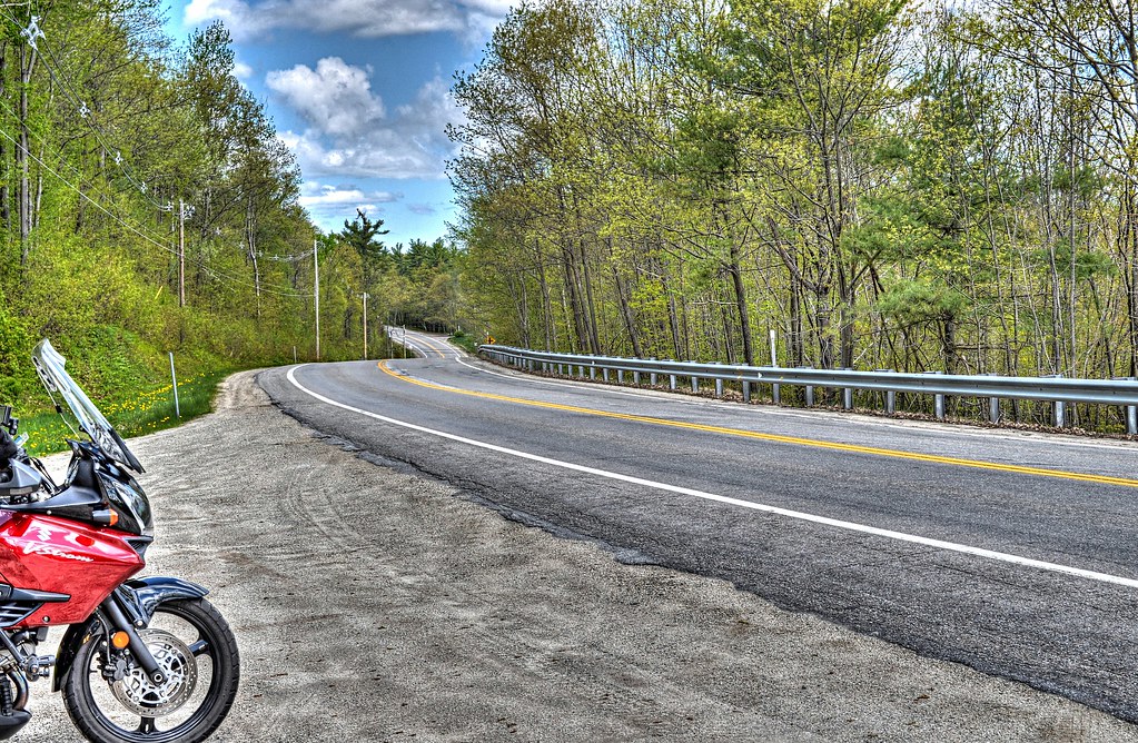
It’s Memorial Day, the weather forecast locally is rain until 10AM and then clearing. Sunapee NH has a similar forecast, so todays ride is on. It is gonna be a blast up I290/I190 just to get out of the state. I invited Giff along for the ride, however he choose to head to Vermont instead with Denise, his wife.  

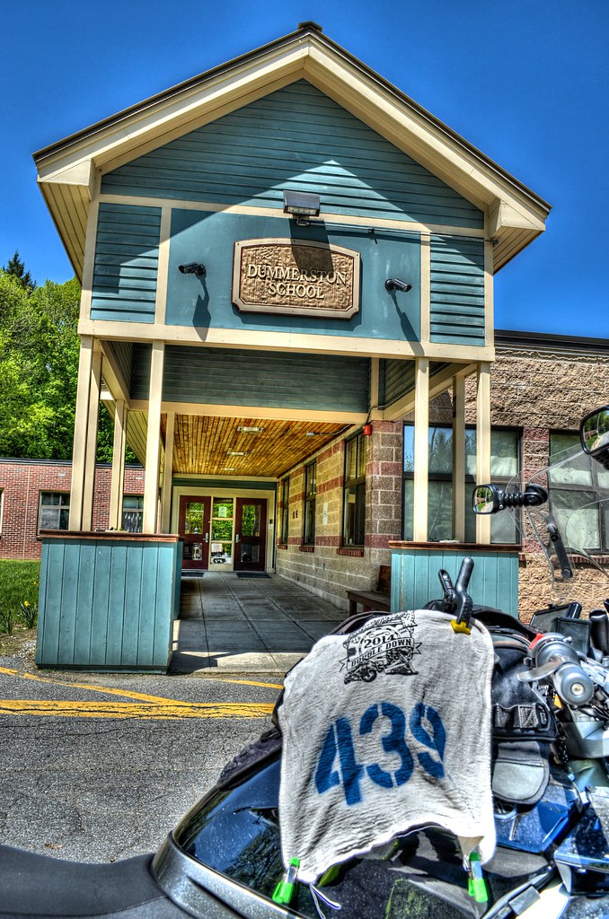
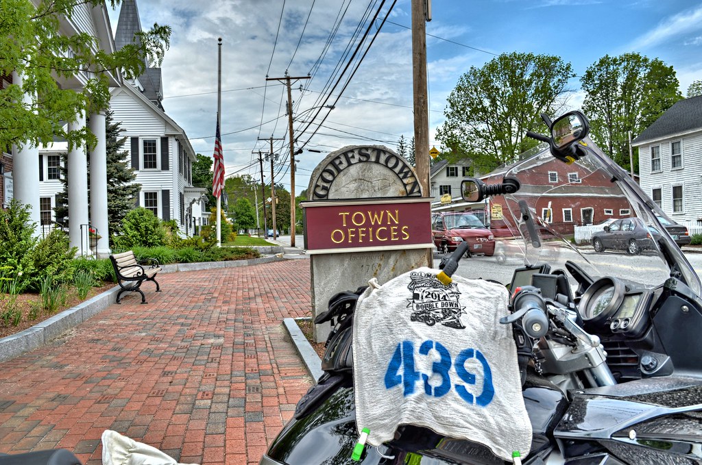
Arrive in Milford NH, pass the renovated depot station, and come across a detour sign. Follow the arrows and there is another detour sign. Follow this one to. Then the detour signs just stopped. No getting back on track, they just stopped and left you on your own. OK I am lost, the GPS wants to go thru Milford, there was probably a parade or other festivities going on. First chink in the armor. I have no idea how to reroute myself to Stoddard, NH. Pull out my MapSource map that I printed, see Goffstown is close by (which was supposed to come at the end of the day) and routed myself to Goffstown. The chink is glued back to the armor.

Goffstown, NH Town Hall


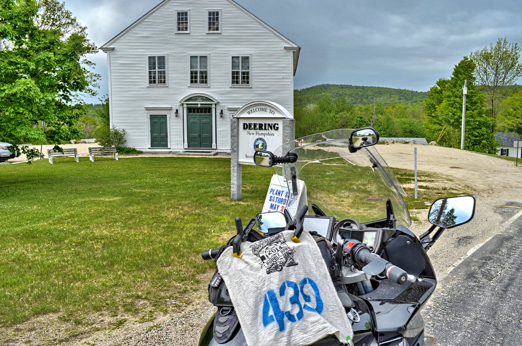
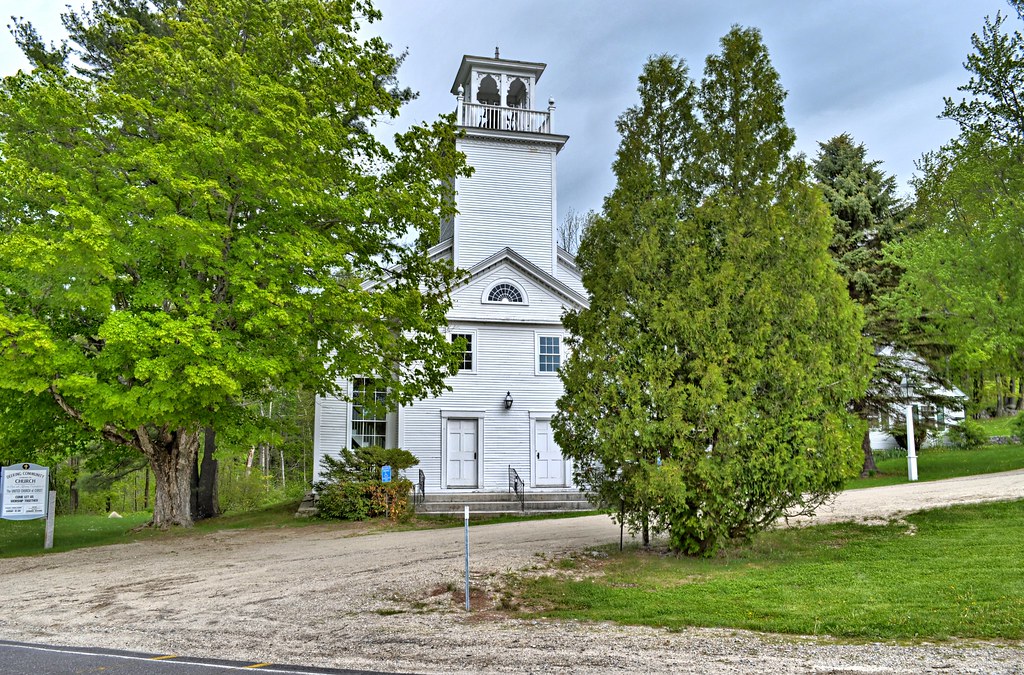
Temperature was nowhere near the 80’s per 2 different weather sites promised. More like the low to mid 60’s and glad I wore a long sleeve shirt. Arrived in Deering, and got the pictures I needed for Double Down. Spent some time taking pics of the church across the street, figuring it was over 100 years old and good for waymarking. It was built in 1829. Deering Town Hall was built in 1788. Deering participated in the big Sheep Boom in the early 1800's and then suffered a decline when the folks went off to work in the nearby mills and the sheep had eaten all the grass up. The folk and blues  singer Tom Rush lived here during the 70's.

Deering, NH Town Hall

Deering Community Church - Deering NH

For the presidents tour you get extra credit (4 point versus 1 point) if you ride to where our Presidents were born and can find a marker that says so. Franklin Pierce, our 14th president was born in Hillsboro.

DSC_2181_2_3WOJ_Real ES


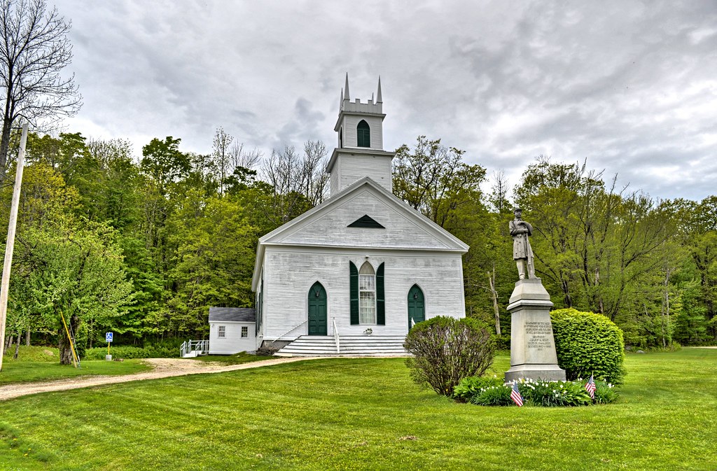
Up route 123 to Stoddard for the Stoddard Congregational Church. Also grabbed the fire department, easier to get STODDARD into the photo. The congregation was formed in 1787 and the church built in 1836. The church was wired for electricity in 1950.

Stoddard Congregational Church - Stoddard NH


Head out of Stoddard to make my way to Washington, NH. Mapsource routed me the shortest way, however Googling the road, it appeared to look like dirt. I did plan an alternate way around, but it was alot more miles. I figured I give it a bid. I hang a left on to Kings Hwy, which was paved. Maybe Google view just looked like dirt. Nope it turned to dirt, but it was a hard compact surface, not too bad. Then the pot holes started, it looked like it was carpet bombed with mini bombs in places. Sometimes it was impossible to avoid the potholes, so I choose the shallowest one to go thru. Never did bottom out the suspension, but was riding the pegs like a dirt biker would. 3.6 miles into this and I came to the inevitable narrowing of the road to a goat path. I KNEW IT I KNEW IT I KNEW IT. Turning around on a narrow dirt road is a challenge for me on the FJR. Not able to flat foot the bike, a bad right ankle doesn’t help, so the turn is made up many little steps, but it does get accomplished. The long way just got longer. Of course I didn’t take a picture of the turnaround spot.


Back in the heart of Stoddard, hang a right on to 123 heading for 10. 123 with the frost heaves and chopped up road was not a whole lot better than Kings Hwy. Motoring along, I sensed something was wrong. Got about ¾ ways to Washington and pulled over to check things out. THE GIVI TRUNK WAS NO LONGER THERE. Damn, damn, damn. Turn around and head back, thinking "RIGHT like I am gonna find my trunk". My biggest concern was the brand new Samsung Mega Smart Phone that was in the trunk. So I have a lot of time to contemplate my ride back up Kings Hwy (you would think a road called Kings Hwy would be paved).


Exactly 2.5 miles into the Road to Baghdad, there it was on the left, a little scuffed up, but still intact and the lid closed. Phone was fine. I say to myself, let this be a lesson not to put the phone in the trunk, tank bag only. Hook the GIVI back on and off we go for the 4th friggin time thru the potholes. Have to pull over because I forgot that new rule about putting the phone in my tank bag. For the rest of the trip I would tuck my left shoulder and arm into my side just so could see the trunk in the rear view mirror, in case the case takes another leap off the bike.

DSC_2217_8_9WOJ_Real ES

Of course I didn't take a picture of the GIVI sitting on the side of the road.


As a side bar, this area does have houses along the way, not a lot but some. One of the places is Mondanock Archeological. This guy must want to live where he thinks the dinosaurs lived. How do I know this, I am re-Googling the areas to see what I was up against. I guess I should have been a little more attentive, because where I turned around is where the roads end in Google. I couldn’t even route myself from Stoddard to Washington this way, but MapSource it found a way.

T 2014 05 26 A
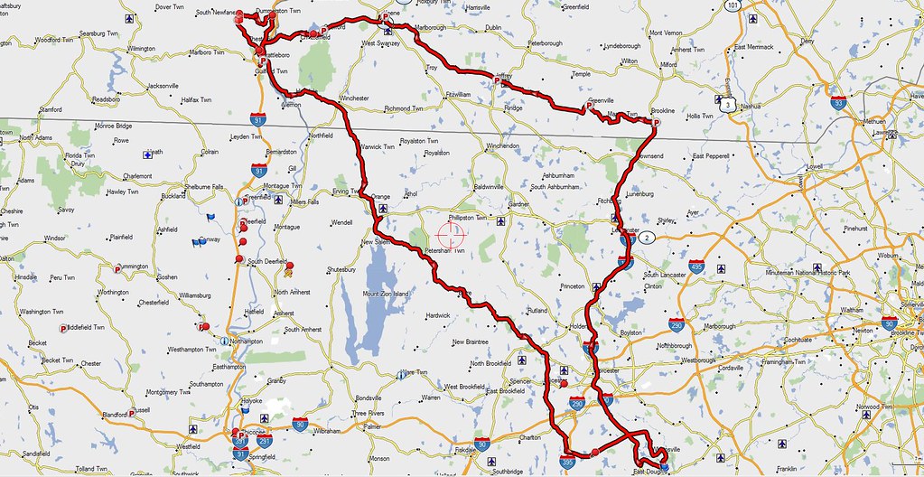
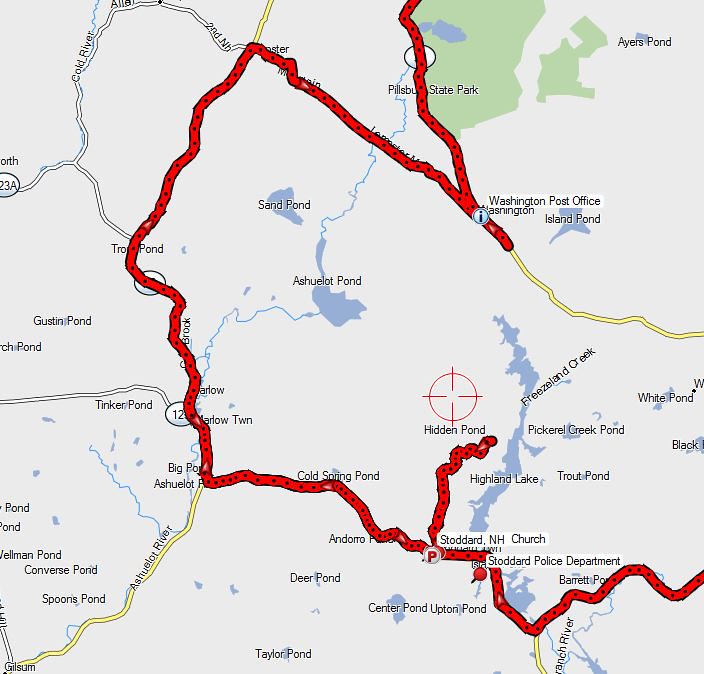
See that lttle stub sticking out of Stoddard NH.

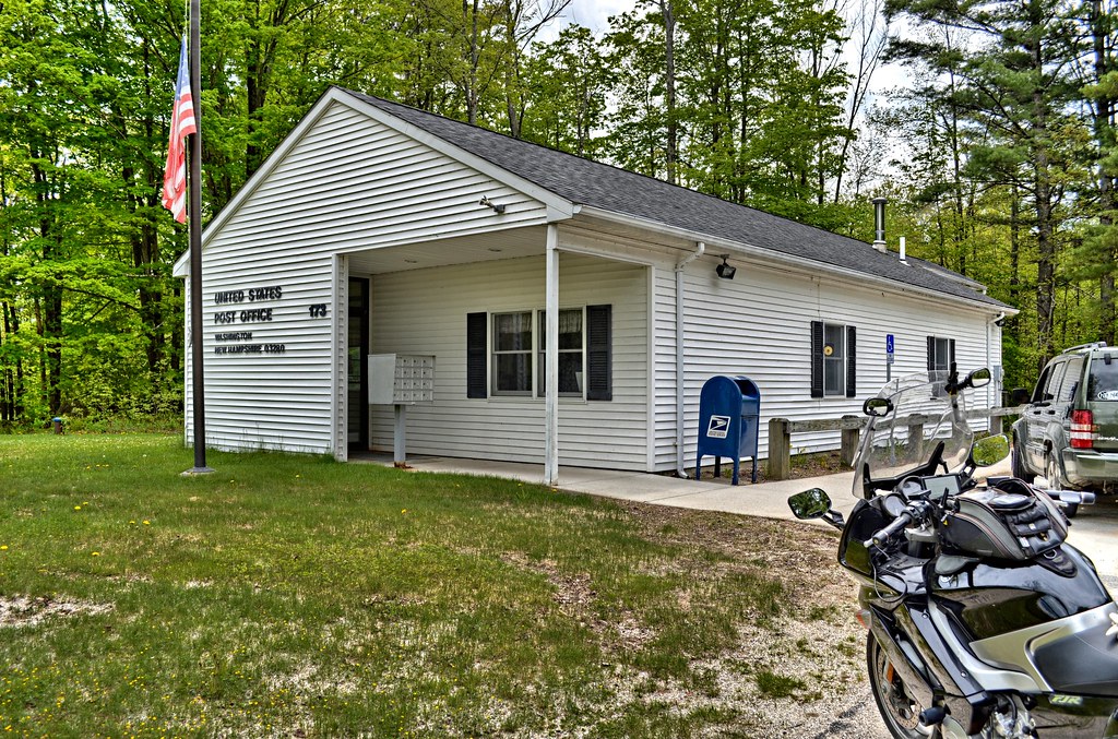
At this point I seriously consider giving up the ride, because I am aggravated and the weather is not that great. I have come this far, at least I am going to get Washington for the President’s Tour. Passing scenery that looks pretty familiar I pull into the center of Washington, ride right past the place where I have the Post Office (has to be the PO for TeamStrange), ride out of town and finally turn around. I stop at the General Store in the center, walk in and ask "Is there a post office in this time, I had it right here". The guy replies "maybe 50 years ago, it is just up the road on 31 on the left". If I had not stopped I would have blown right past the PO.


DSC_2237_8_9WOJ_Real ES


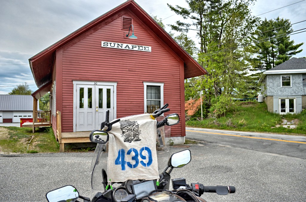
Feeling less aggravated I head to Sunapee to find Steven Tyler. Settle on this building instead.


DSC_2243_4_5WOJ_Real ES


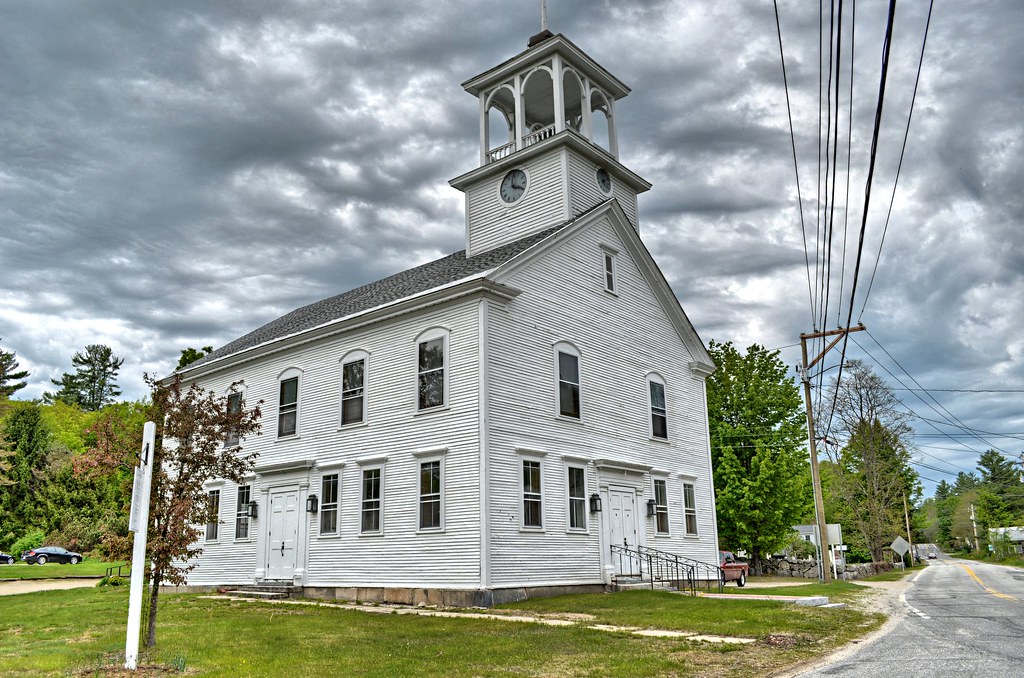
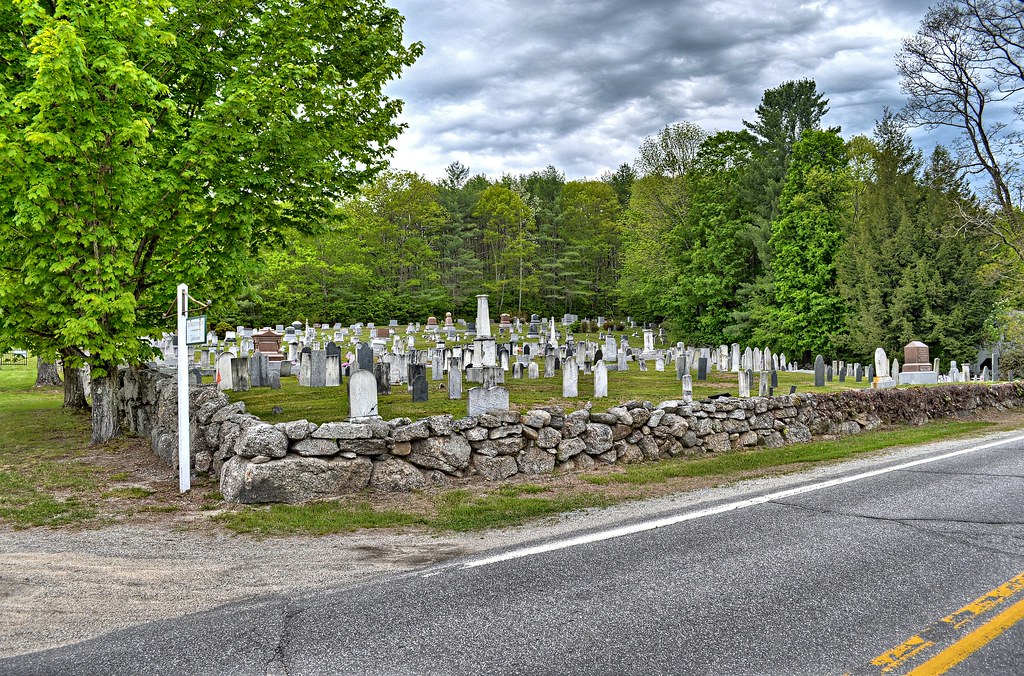
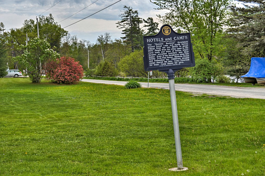
The next 2 towns North Sutton and South Sutton are crap shots. I could find nothing by Googling so this is a ride thru and search. North Sutton turns out to be a hit.

DSC_2282_3_4WOJ_Real ES

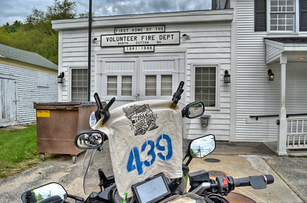
As far as Waymarking goes North Sutton was a little treasure chest. There is the Free Will Baptist Church that is over 100 years old, with a clock in the tower (another category) right next to a cemetery, which is right across the street from a New Hampshire historical marker (another category)

Free Will Baptist Church - North Sutton, NH

DSC_2300_1_2WOJ_Real ES

DSC_2306_7_8WOJ_Real ES


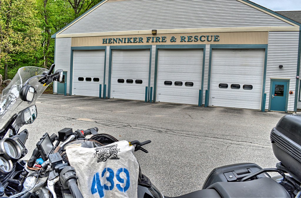
In South Sutton I could find nothing so headed for Henniker.

DSC_2315_6_7WOJ_Real ES

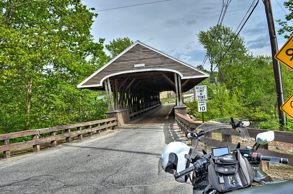
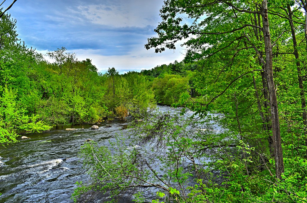
Rowell’s Covered Bridge is 164 feet long, cost $300 to build and listed on the National Register of Historic Places. It spans the Contoocook River, located in Hopkinton, NH.

Rowell's Covered Bridge - West Hopkinton NH

Rowell's Covered Bridge - West Hopkinton NH

Contoocook is a village of Hopkinton, NH and has a really neat railroad covered bridge that served the Concord & Claremont RR and then Boston & Maine RR. It is listed on the NRHP, built in 1889 and is the oldest existing covered RR bridge in the US. The last time it saw a train was in 1962.
Hopkinton Railroad Covered Bridge - Hopkinton, NH

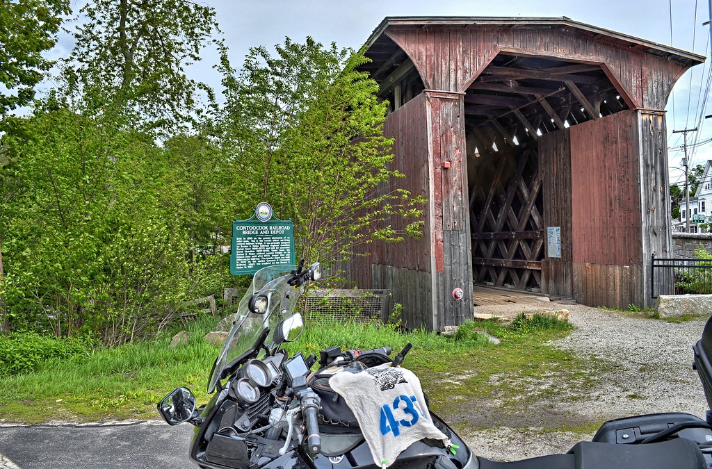
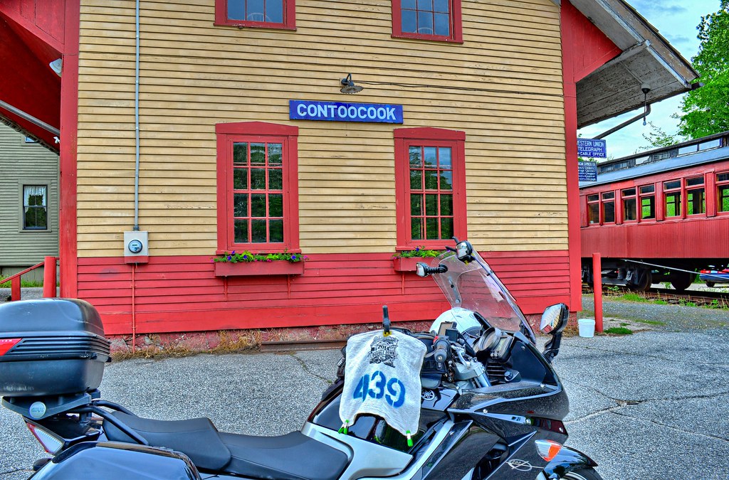
Right around the corner is the Contoocook Railroad Depot built in 1849. It too is listed on the Register.

Contoocook Railroad Depot - Hopkinton NH


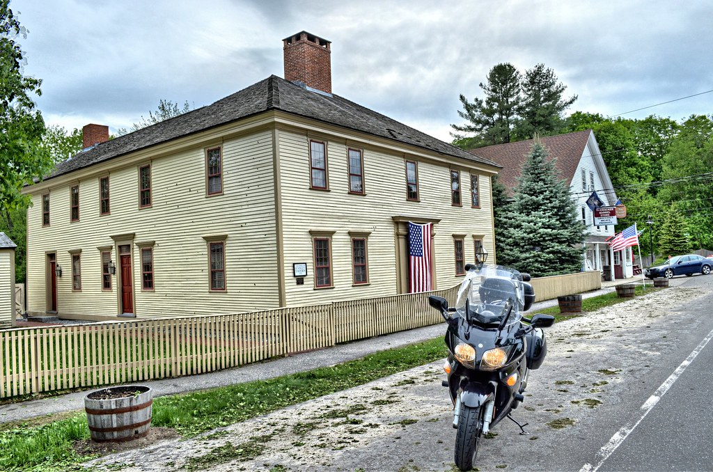
Heading out of town is the Stanley Tavern, built in 1791 by Theophilus Stanley, serving as a tavern until 1864. Hopkinton had 3 taverns back in its day, when it was competing for the capital of New Hampshire. It is on NRHP

Stanley Tavern - Hopkinton NH


Right down the street is William H Long Memorial Building which houses music scores, journals, diaries, books, maps and other artifacts.

Long, William H., Memorial Building - Hopkinton, NH

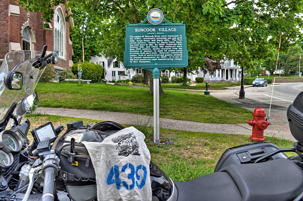
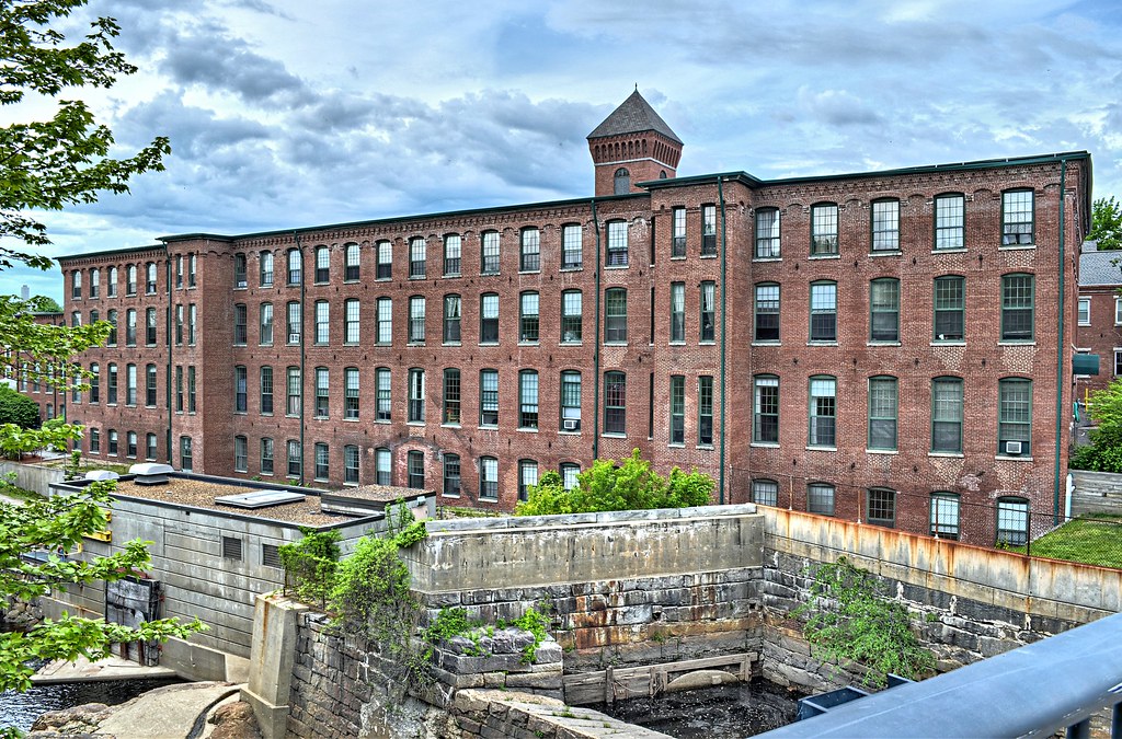
In the town of Pembroke I picked up 2 things. Right next to the Suncook Methodist Church is this sign. Suncook served as the center of commerce and social activity for the towns of Pembroke and Allentown in the mid 1800’s and early 1900’s. Like many towns located along the Merrimack River Valley, it was a regional mill town on par with Manchester, Nashua and the power house Lowell.

Suncook Village NH Marker

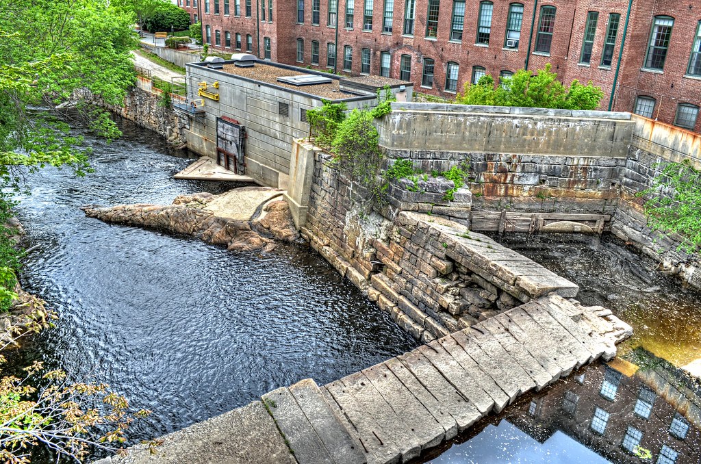
The Pembroke Mill was built in 1860 by the Suncook Manufacturing Company was the first major industrial area developed along the banks of the Suncook River. It is located on the falls for harnessing the hydro power. The mill employed 225 local folks producing 110,000 yards of cotton. In the 1950’s thru the 80’s the mill manufactured furniture. Today is residential property.

Pembroke Mill NH

Pembroke Mill

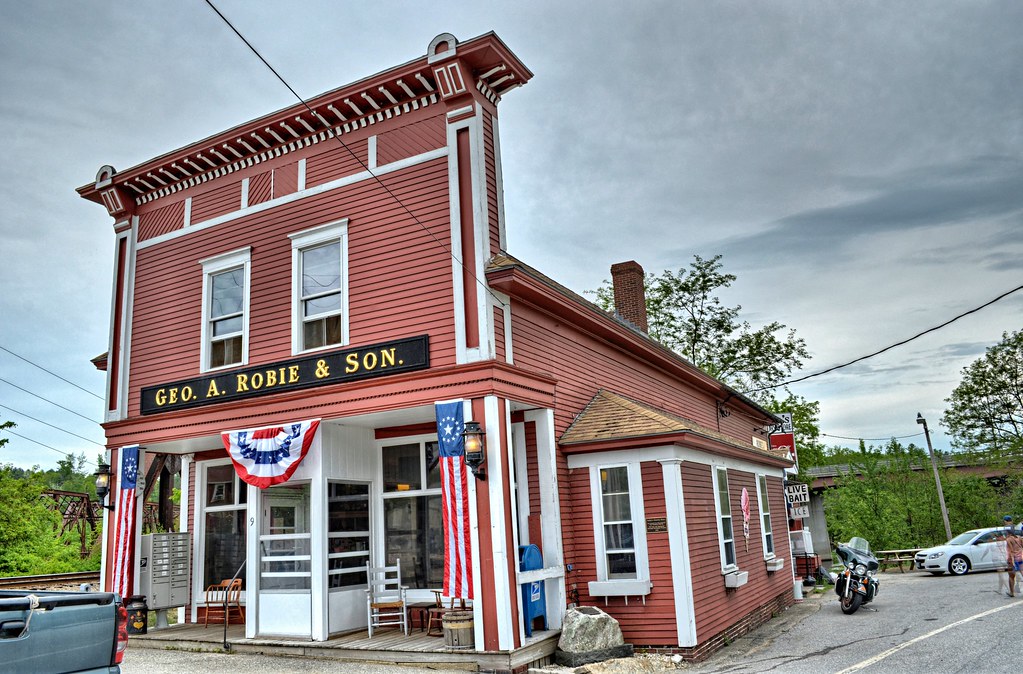
Robie’s Country Store was built in 1822 and remained in the Robie family for 110 years starting in 1887. The shop flourished because of LOCATION LOCATION LOCATION (check out its location in Google 43.096508,-71.464128 ) and has been known to have presidential candidates stop in the store since the 1950’s. Of course it is on the Register.

Robie's Country Store - Hooksett NH

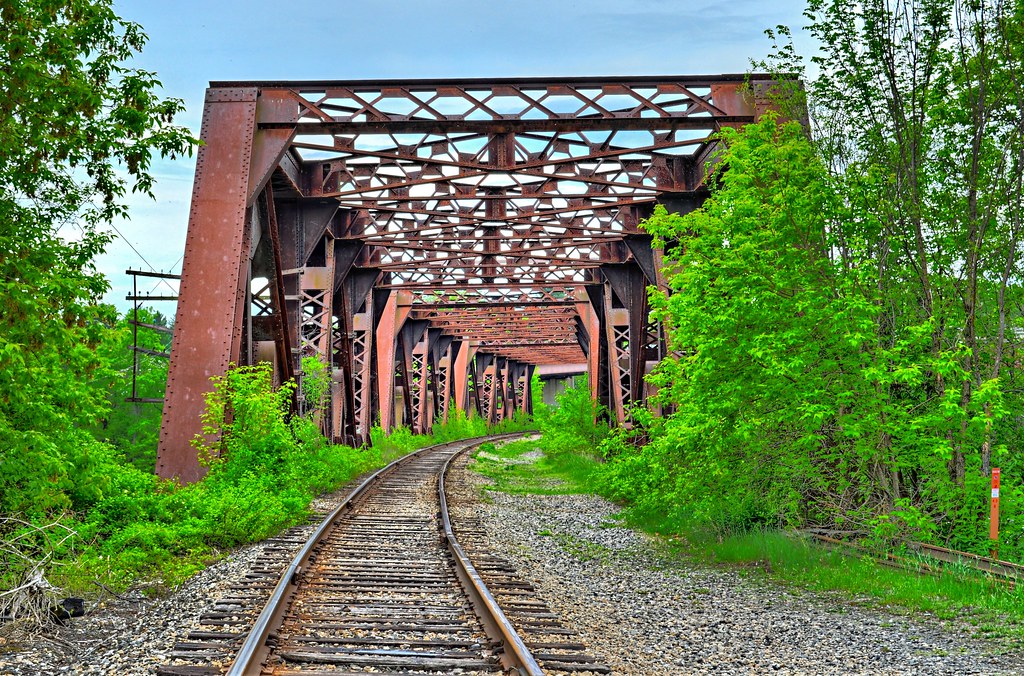
These RR bridges are right next to the Robie Store.

Bridge by Robie's Country Store - Hooksett NH

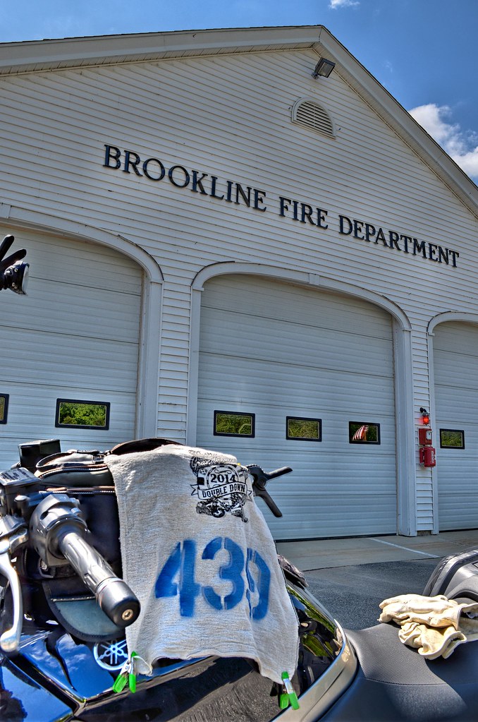
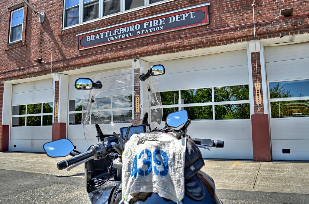
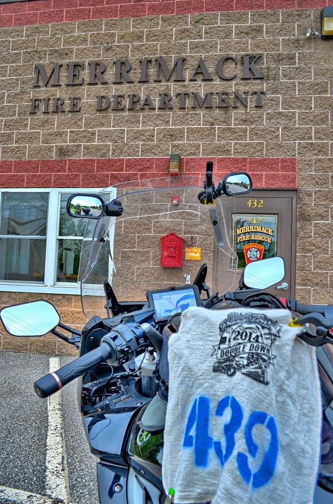
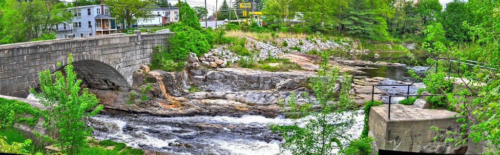
Last stop in New Hampshire is the Merrimack Fire Department. Nothing real special about the fire department other than the double letter, but the view of the Souhegan River and arched bridge is pretty neat.

Merrimack Fire

DSC_2483_4_5WOJ_Real-DSC_2489_90_91WOJ_Real EC

It was here that I pulled my phone out to check where my last 4 places are. I am supposed to go to Londonderry, Derry and East Derry. Bring up the maps I have saved in Google gives me a quick confirmation that I can blow these off for another trip without really going out of my way. This was just frosting on the cake.

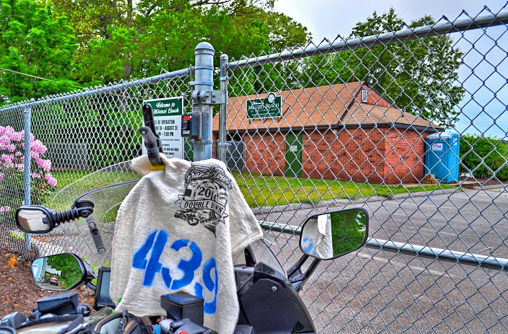
Nutting Lake was another story. It is just hanging out there all by itself and really needed to be gotten today. I know there is a Post Office because I got the place for the An Affair with Water Grand Tour, but PO’s can’t be used. I did Google this place and that will have to do.

Nutting Lake

Nutting Lake is the last stop of the night. What started out as a do I go or don’t I go, somewhat aggravating at times, bumpy for sure was all forgotten as I headed home. It did start to sprinkle, however I saw clear skies in front of me and throttled up down 128 to the Mass Pike and home. Pulled in right around 7pm with 350+ miles for the day.


Slide Show can be found HERE. It has some scenes not previously shown. WOO HOO


T 2014 05 26

Wednesday, May 21, 2014

Humping Hampshire Horizontally

Today my buddy Giff is going along for the ride. He knows we are taking highway to get out of MA ,we will be stopping along the way for me to take pictures for the Double Down Tour and the TeamStrange Airheads 30th Anniversary Tour and he still is going for the ride. He just might end up on some roads he has never been on. Departure time is 9am. I have been up since 5 and finally got the FJR out of the garage around 8, put the GPS's on (actually only put 1 on today, so that I could see my turn signal indicators)and prepped and packed the cameras.

We blasted out 146 to I-190 to RT 2 and then turned off, heading for New Hampshire via 13. With Worcester, Fitchburg and a bit more scenic Townsend behind us we crossed the border making our first stop in Brookline, NH.

( For you folks that don't want to read no stinkin ride report CLICK HERE for pictures only.)

DSC_1901_2_3WOJ_Real ES


As we started to head out, the GPS looked like it was trying to route us back to Townsend and head over 119. Must have been bad routing on my part, with a wayward waypoint on the route. Simply pulled up the next stop for a pizza joint a little north and west. The road to the next stop was a nice twisty back road that the winter had taken it's toll on and lack of funds in the city coffers to fix the roads, so speeds were down. It's Sunday anyways and the weather is near perfect, with just enough crispness in the air to keep you alert.

We arrived in Greenville and the Greenville House of Pizza was either sold and the name was changed or was wrong to begin with. Pulled right on the sidewalk in front of the Greenville Town Hall for the stop.

DSC_1907_8_9WOJ_Real ES

Just as we get going I pull over to grab this NH historic marker. I have been chasing these for the last 4 or so years and almost have them all. I remembered the mill across the street and missing the marker awhile back.

First Textile Mills - New Ipswich

Giff waiting patiently for me to finish up.

DSC_1919_20_21Painterly ES

Headed west on Turnpike Rd (NH 123/124) for another pizza joint. Seems whenever I Google places in a town with the town name in it, pizza places seem to make the top 5 hits and seem to have street view to verify the sign has the town name. I have learned to stop at the first name I am seeking versus hitting on a hard destination.

DSC_1922_3_4WOJ_Real ES


Fire departments work real good. For the most part they always have the town name in big letter format. Giff waiting again

DSC_1928_29_30Painterly ES

Road thru the center of Keene, passed the Coka Cola classic wall mural, that is really washed out. One block over is the Parrish Shoe Company sign used in the movie Jumanji with Robin Williams and Kirsten Dunst. There was a guy sitting at the entrance with his dog and laptop. I figure he was using the free WiFi available from the library.

DSC_1937_8_9WOJ_Real ES

I haven't had a bit to eat all morning and asked Giff if he was hungry. He said follow me and we ended up here.

DSC_1940_1_2Painterly ES

After a some coffee and a bagel, we headed for Spofford, NH. We were traveling along RT 9 headed west and I found a place with a small sign for Spofford Boat Sales. Google indicated they had a good sign, but I was skeptical. Buzzing along I caught the Spofford Fire Department off to the right and hung a U turn and headed back for a much better sign.

DSC_1946_7_8Painterly ES

When I proposed this ride to Giff, I said I am heading for RT30 in Vermont for a RT30 sign, do you want to come?. I added all the stuff on before Brattleboro. Traveling north on RT30 was pure pleasure. For some reason Vermont roads don't seem to be impacted by the winter weather and frost heaves. Even their dirt roads are great.

DSC_1952_3_4Painterly ES

This was for the TeamStrange Anniversary Tour. Just up the road abit is West Dummerston VT. I have been in this town a couple times, it is off the beaten path for the Post Office for the Tons and Burg Grand Tour. I really didn't remember what else was in the town, but I had marked the West Dummerston Baptist Church as a target. When I pulled up the church was there, but any signs of West Dummerston were gone. I don't think the Baptist practice their faith her anymore. Right next to the church was a stone that did say West Dummerston Honor Roll so I pulled out to turn around and low and behold this was presented to me.

DSC_1955_6_7WOJ_Real ES

I ended up walking around a bit taking some pictures of the town figuring the church was well over 100 years old for waymarking and just might be on the National Register of Historic Places. Actually there was another church within a stone throw, but I didn't go after it.

We headed back out to RT 30, hung a right off 30 and crossed over the Dummerston Covered Bridge (no pic) and took the right branch over the bridge heading on East West Rd. When we got to the center I thought the Grange building said Dummerston on it, but it says Eternal Star or something like that. From a distance it looked like Dummerston to me. I ended up taking the wrong road out of the center to Dummerston School. The GPS did what it is suppose to do, reroute us, however the first road was dirt and I was just not in the mood for going down a road that we might have to turn around. Passed that one and GPS has us turning left right after that. It is dirt and I sigh and said to myself this is Vermont and dirt roads here are better than the roads in my home town so left it is. It really was fine, it is the anticipation that gets to me.

DSC_1982_3_4Painterly ES

That was our second to last stop with Brattleboro the only remaining town on the list. Giff said you want to get something to eat, I know a couple places. He gave me some choices and rather than deciding, I said I will follow you. Lunch was to be had at this joint. I didn't grab this for the Smoke Chasing Tour, because BBQ was not in their name.

DSC_1988_89_90Painterly ES

When I pulled into the parking lot, 3 bikes caught my eye, but the Honda really really caught it. At first I thought it was a 750-4 Super Sport. The 400 four was manufactured between 1975 and 1977, with about 105,000 produced during these 3 years. For its day, it was a pretty good handling bike, so they say. Right behind it is a vintage Triumph and you can see the tail end of a BMW.

DSC_1991_2_3Painterly ES

I was so busy snapping of pics, that Giff ordered and made his way to the tables. I finally made it up to the window, not having a clue what I was going to order and then I saw CAJUN CATFISH. I was discussing this with MeAsWe and a couple at Kapi's, reminiscing about a play in Uxbridge. I just had to have it for old time sake. With the order placed I made my way back to the table area, which has this great view.

DSC_2012_3_4WOJ_Real ES

Giff was in a discussion with the 3 folks right next to us. It turns out they were the riders of the 3 vintage bikes in the parking lot and Owners / Workers at Vintage Steele on RT 5 just outside downtown Brattleboro. They were just having a bite to eat (I think it was just an excuse to ride because the weather was perfect) and invited to visit them at the shop.

DSC_2017 ES


Finishing our lunch I said to Giff I just need to get some place in Brattleboro and that completes the list for the day. I said I got the Fire Department marked and it is only a mile or so away. I headed out and made my way to downtown Brattleboro. Taking pictures, especially city type fire departments are somewhat intimidating. As I pull up, get my bike semi parallel with the building in front of the doors, I always have this fear that doors are going to open and the fire engine come barreling out and running me down. So far (where's that wood) this hasn't happened. Just as I finished taking my pictures, the doors open up, the firemen climb into the cab and I break into a sweat. With nerves of steel, I put my flag and camera into the tank bag, mount the bike and move out of the way. No getting run down this time.

DSC_2042_3_4WOJ_Real ES

So my mission is accomplished and Giff takes the lead out of Brattleboro to look for Vintage Steele. It is supposedly just as you drive out of town on US 5. We search and search and finally give up and head for the first gas station. Then Giff says can you look it up on your phone, I say sure and move to the trunk to pull out my Jitterbug of SmartPhones. As I am putting the key in Giff says "look vintage bikes" pointing across the street.

DSC_2072_3_4TM W ES

DSC_2081_2_3WOJ_Real ES

DSC_2051_2_3WOJ_Real ES

DSC_2045_6_7TM P ESS

We spend about half an hour there chit chatting and headed out toward home. Giff took the lead for the rest of the day as we headed south thru Orange, down 122 next to the Quabbin and thru Oxford. Just about 5 miles from the house, I spotted another sign and pulled over. I did beep my horn to let Giff know I was pulling over for a sec.

DSC_2087_8_9TM W ESCF

All in all, it was a great day of riding, good company, perfect weather and I got 8 more towns and 1 place for TeamStrange.


UL 2014 05 18